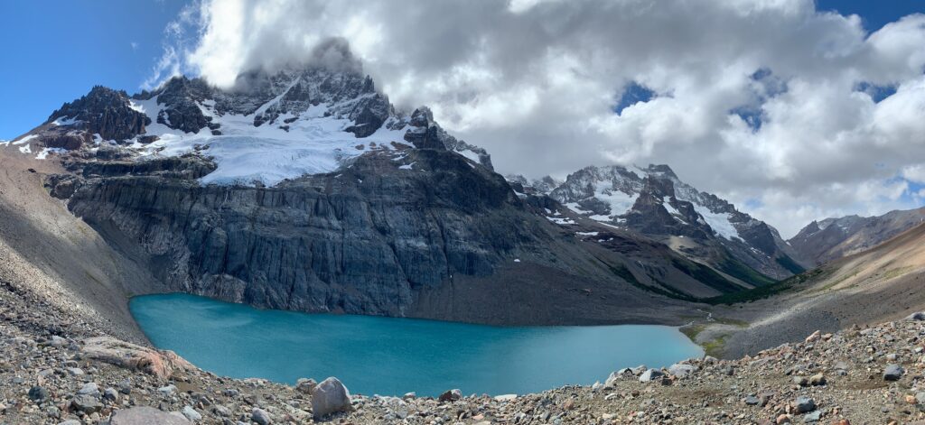
Laguna Cerro Castillo and the snow capped mountain that bears the same name
Highlights
Challenging 13 kilometer out and back hike with phenomenal valley views culminating at a deep blue colored alpine lake fed by melting waters of a hanging glacier. The jagged snowy peaks of Cerro Castillo provide a nice contrast to the blue alpine lake and blue sky..
Time of Visit: February 2024
Description
Cerro Castillo is a striking mountain in the Aysén Region of Chile. It has dramatic peaks and beautiful scenery. The name “Cerro Castillo” translates to “Castle Hill,” which refers to the mountain’s jagged spires resembling a castle’s turrets. Rising to 2,675 meters (8,776 feet), the mountain is part of the Parque Nacional Cerro Castillo, which spans approximately 179,550 hectares.
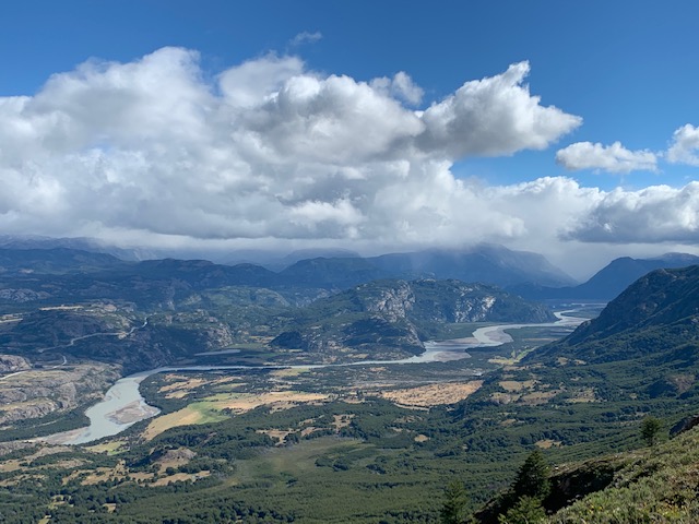
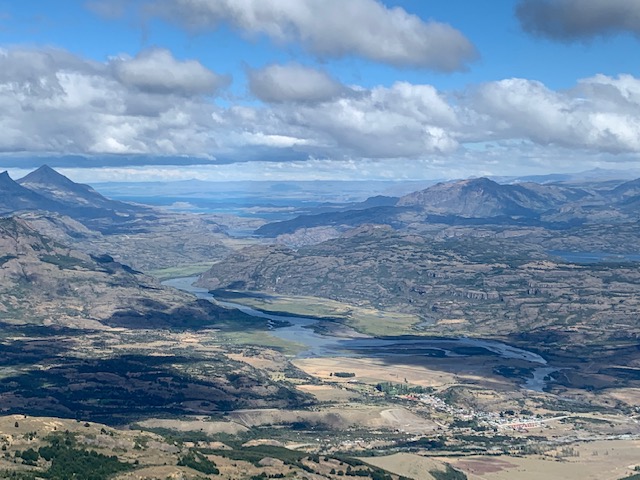
The area is a paradise for outdoor enthusiasts, offering diverse activities such as trekking, mountaineering, and camping. The most famous route is the Cerro Castillo Circuit, a challenging multi-day trek that provides hikers with breathtaking views of glacial lakes, dense forests, and the rugged Patagonian landscape.
But if you do not have time for a multi-day trek, a 13 kilometer out and back trail to Mirador Laguna Cerro Castillo provides a sampling of the area’s beauty. The trail does not receive a lot of visitors according to the park rangers, often around 200 people a day, so it offers a solitary and pristine experience.
The Hike
Distance to Mirador Laguna Cerro Castillo: 6.5 kms (4 miles) one way.
Elevation Gain: + 1,000 meters (+3,300 feet)
Total Time Needed: At Least 6 hours (3 hours up, 1 hour at the destination, 2 hours down)
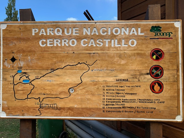
Trailhead: At Parque Nacional Cerro Castillo on Camino Estero del Bosque road about 4 kms from Highway Ruta 7 and the Barrio Cerro Castillo.
Fee: 16,000 CLP per person
Time Restrictions: 1 PM cutoff time at the trailhead. 3 PM cutoff time at km 5. 4 PM closing time at the mirador.
Park Entry Permit

Park entry permit can be bought at the park office. Visitors are required to complete an on-line form that asks for basic information such as name, country or residence, passport number and contact information. The on-line form also requires visitors to attest that they are fit enough to complete the hike (basically they do not want to rescue you later). I did not have cell service in the park but fortunately they had free Wifi so that I was able to complete the on-line form.
Only when the on-line form is completed is when the park ranger issues visitors a paper entry permit. The park ranger also has a log book so they can keep track who went in and returned.
Trail Description
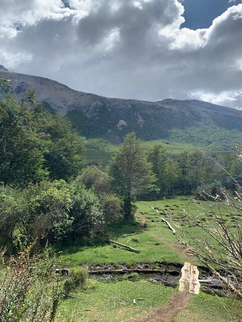

The trail immediately climbs steeply for the first kilometer through the forest. After kilometer one, the trail goes through the transition zone from forest to shrubs until reaching kilometer four. It is a nice easy walk between kilometer two and kilometer three. Past kilometer three, the trail resumes its steep ascent up to the mirador. Past kilometer four, the trail becomes more open as it gets above the deciduous treeline.
There is a ranger outpost at kilometer five. It is roughly 45 minutes to an hour to get to the mirador from the ranger outpost. The ranger at the outpost will check for the paper entry permit that was issued at the trailhead. The ranger will also remind visitors of the 4 PM closing time. Believe or not, the ranger will make the uphill trek in the afternoon to check the area to make sure those on the day hike have come down.
Getting To The Trailhead
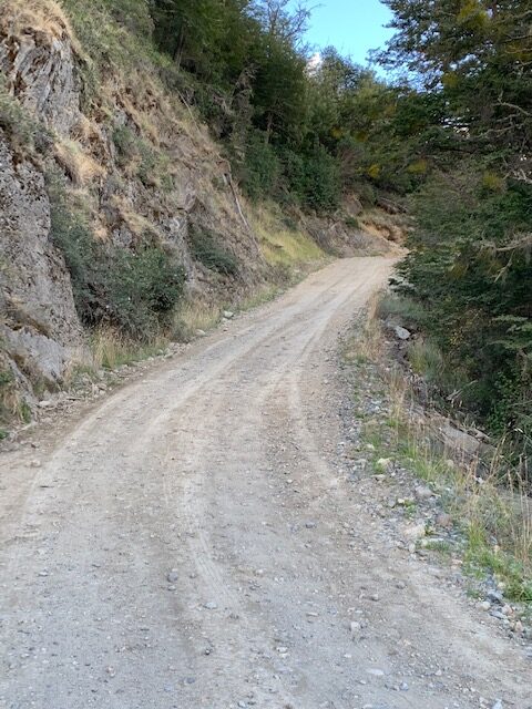
There is a CONAF (park) office at Barrio Cerro Castillo where Camino Estero de Bosque meets Ruta 7. You can ask questions here if you like but in all likelihood the ranger does not speak English. Instead, continue on Camino Estero de Bosque for about 5 kilometers. The road is graded dirt and gravel road.
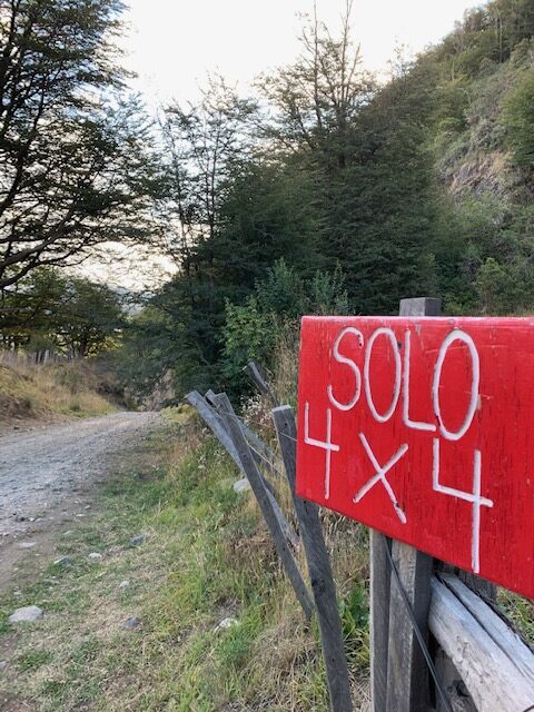
At about one kilometer from the park, there is a sign on the road that indicates 4×4 vehicles only. The dirt road then descends “steeply” for about 100 meters (330 feet) or so. I have driven regular cars on steeper dirt roads without any problems. I think the 4×4 sign is there in case the road is wet and muddy which would be an issue for two wheel drive vehicles.
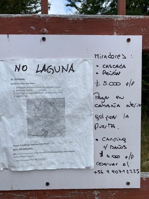
Some blogs indicate that there is a trailhead on private property a few hundred meters from the Ruta 7. I think I found that private property trailhead which is just a few meters past the “U” bend on Camino Estero de Bosque. The but there was a sign that clearly indicated “No Laguna”. There is a small kiosk structure at the private property gate but there was nobody manning it. Plus, the ranger at the park office said that the trailhead is past the 4×4 sign.
Where to Stay
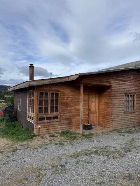
Barrio Cerro Castillo is the closest community to the national park. The barrio is just a spec on the road. You would miss it if it wasn’t for the reduced speed sign upon entering the community.
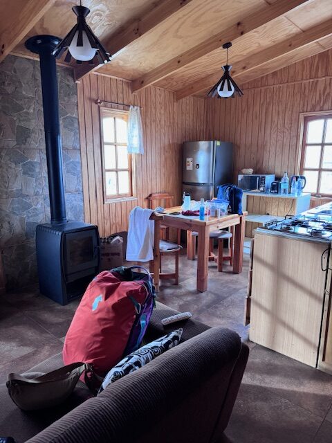
There are a few accommodations in Barrio Cerro Castillo, mostly cabins and guesthouses. We stayed at Cabañas y habitaciones Ruta 7 Sur. They have a restaurant and offer two kinds of accommodations – room only and housekeeping cabins. We stayed in a cabin that had a cast iron wood burning stove to heat the living space. There was no heat provision in the bedroom but we did not get cold at night being under the warm blankets provided.
The experience was rustic but OK. The only issue we had was the plumbing was not done correctly as there was a sewer odor emanating from the bathroom. So we had to keep its drain covered (plugged) unless we were taking a shower.
Summary
Parque Nacional Cerro Castillo is a lesser known destination in the Aysén Region of Chile. The park is not well developed as well as the nearest community Barrio Cerro Castillo. As such, it does not receive a lot of visitors.
The park has astounding natural beauty, challenging hikes and jaw dropping views. A challenging 13 kilometer out and back day hike to Mirador Laguna Cerro Castillo provides all three. Snow capped mountain, a hanging glacier and deep blue Laguna Cerro Castillo awaits the triumphant hiker. Visitors can experience solitude while exploring the park.