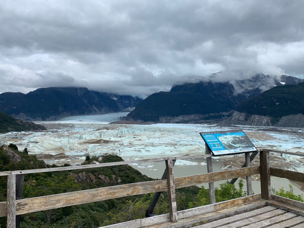
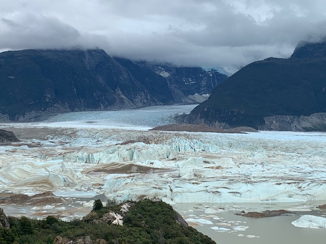
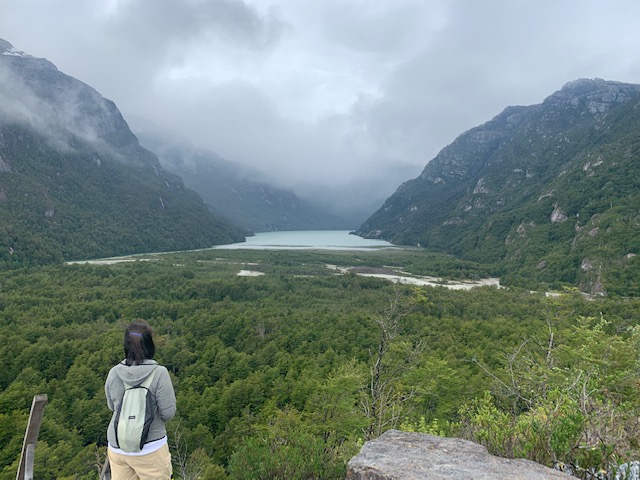
Glaciar Exploradores from the Alto viewing platform
HIghlights
Five kilometer out and back hike to fantastic views of the Glaciar Exploradores within the Parque Nacional Laguna San Rafael. The national park is about 53 kilometers or an hour and half drive from the community of Puerto Rio Tranquilo.
Time of Visit: February 2024
Length of Visit: Day trip from Puerto Rio Tranquilo
Description
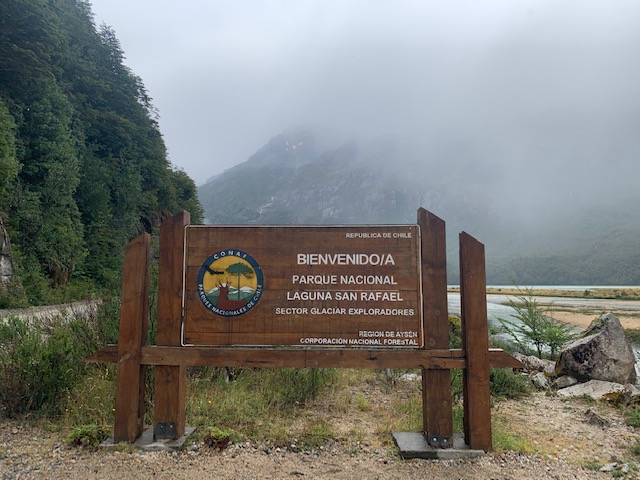
Glaciar Exploradores is part of the massive Campo de Hielo or Patagonia Icefield in southern Chile. Glaciar Exploradores is within the Parque Nacional Laguna San Rafael which is a pristine park tucked away in the remote part of the Aysén Region. Established in 1959, the park covers approximately 17,420 square kilometers. It is one of the largest national parks in Chile. It has dramatic landscapes including dense temperate rainforests, rugged mountains, and the massive San Rafael Glacier. The San Rafael Glacier drains into Laguna San Rafael for which the park was named after.
The Glaciar Exploradores is mostly ignored compared to the more dramatic San Rafael Glacier. The most common and scenic way to see the San Rafael Glacier is via boat tours departing Bahía Exploradores or by multi-day cruises departing from Puerto Chacabuco. The destination of these tours and multi-day cruises is the Laguna San Rafael where the San Rafael Glacier terminates. The tours and cruises navigate the Aysén Fjord that offer stunning views. As such, the effort to see the glacier is substantial and the cost can be pricey, depending on the tour or cruise length.
But the Glaciar Exploradores should not be brushed off from anyone’s itinerary if they find themselves in this area of Chile. This glacier and the surrounding mountains holds its own when it comes to beauty and serenity. Best of all, it is not difficult to see if you are willing to go on a moderate 2.5 kilometer hike. Here we describe how to see Glaciar Exploradores.
How To See Glaciar Exploradores
Getting to Parque Nacional San Rafael
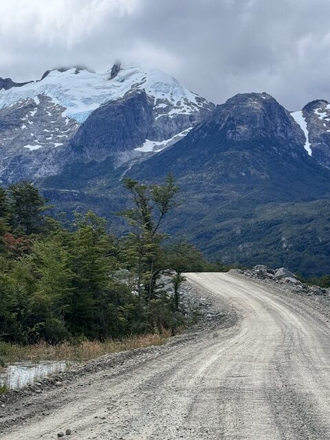

The park office is located about 53 kilometers from Ruta 7 at Barrio Puerto Rio Tranquilo. The drive is on Ruta X-728 or Camino a Bahia Exploradores which is graded dirt and gravel with some washboard sections. It is passable by ordinary car though it may take a while. It took us about an hour and half to reach the park office on a 4X2 mid-size pick-up truck.
The drive offers some scenic sections that show snow and glacier covered mountain peaks, colorful lakes and the Cascada Nutria just off the side of the road.
We passed by a Class C motorhome on its way to the park. The RV had a side scratch as it brushed against a pick-up truck going the other way. There are some spots on Ruta X-738 that are not wide enough for two vehicles. Also, there are some blind curves that it would be prudent to slow down to avoid any mishaps with oncoming traffic.
There are three single lane wooden bridges that need to be crossed to reach the park office.
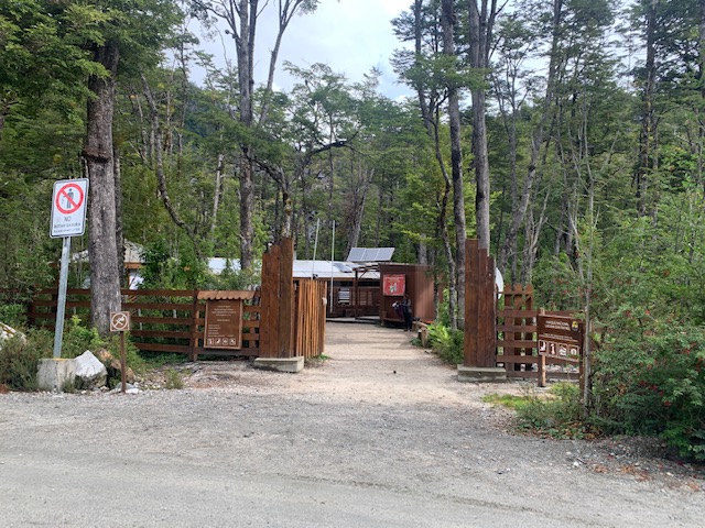
The park office is not shown on Google Maps. There is small park office sign on the side of the road that is easy to miss. You will encounter cars parked on the right side of the road immediately after passing the third wooden bridge. Just find a spot to park. There is a parking area a few meters further but that belongs to Parque Exploradores which is private and not part of the park.
At The Park Office (Rifugio CONAF)
Visitors need to check in with the rangers at the park office, register and pay the park entry fee. This is one of the Chilean national parks where visitors do not have to purchase the entry ticket on-line (at least during the time of our visit), probably because it is so remote. The cost was $5,500 CLP per person for Chileans and $11,000 CLP for foreigners. There is no cell service here so be ready to pay in cash.
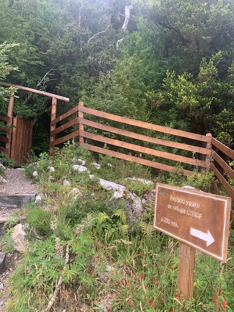
There is a log book where visitors need to enter some information so the rangers can track the people that went in and out. The rangers will give a short briefing about the hike and the destinations which are two glacier viewing platforms.
The park office and the trailhead is open from 8:30 AM to 1:00 PM, Tuesday to Sunday. Just like other CONAF offices we encountered, they are closed Mondays.
The Hike
Conservatively, it takes about four hours to complete the hike, including time spent at the viewing platforms.
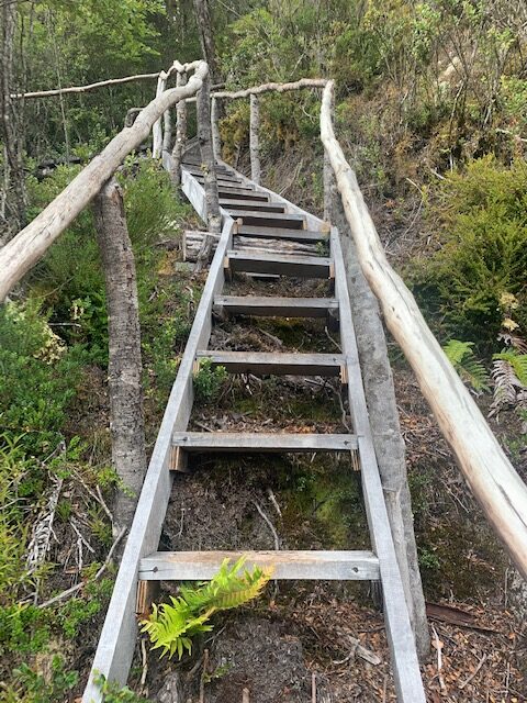
From the park office, walk back towards the wooden bridge. Take a right immediately after the bridge and you will encounter some exhibits about the hike. The first twenty minutes after the exhibits go up and down on wooden stairs as the trail follows the undulating contour of the mountainside. It is shaded the majority of the way as it makes it through the forest. The trail is over roots and rocks and has wet but not muddy sections.
There are two “miradors” or viewing platforms – Bajo (low) and Alta (high). Mirador Bajo gets you closer to the glacier compared to Mirado Alta. Mirador Alta provides a panoramic view.
Mirador Bajo is 500 meters from the main trail. It initially goes down only to climb up to get to the wooden platform. The ranger said there we had to descend 300 meters (1,000 feet) to Mirador Bajo from the main trail. After completing the trail, we think the ranger meant that the 300 meters is the total elevation gain going from and coming back to the main trail. I guess what we are trying to say is that it did not feel like a tough climb to and back from Mirador Bajo.
Multiple waterfalls fed by other melting glaciers up high in the mountains can also be seen from the viewpoints. There was one waterfall that was particularly tall that resembled Angel Falls in Venezuela. We stayed for about an hour at the Bajo viewpoint while eating our lunch.
Parque Exploradores
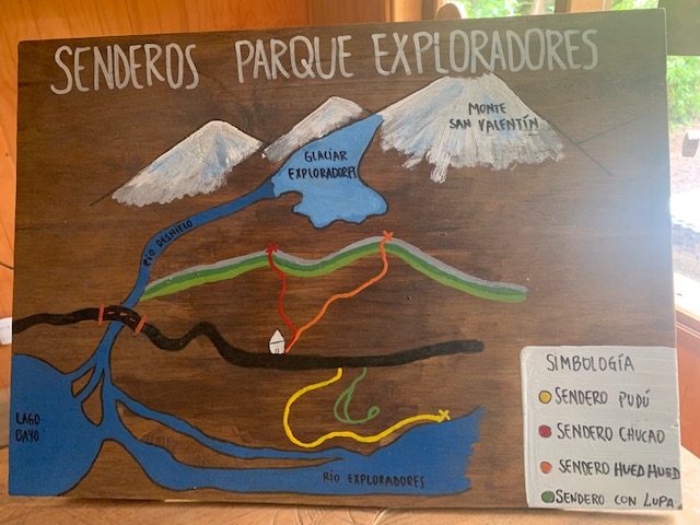
Parque Exploradores is a private park just a few meters from the national park office. Parque Exploradores has a sign on the roadside so you may mistakenly think it is the national park.
This private park charges visitors a modest admission fee. The admission fee allows visitors to complete a couple of hikes to the glacier viewpoints at the end of Sendero Pudu and Sendero Chucao. The hikes are short at around one kilometer each but steep in the last 400 meters or so.
The viewpoints are far from the Glacier Exploradores, unlike the viewpoints of Parque Nacional San Rafael. You would not miss anything with regard to the glacier if you skip the hikes in this private park once you completed the five kilometer hike in the national park. But the view of Lago Bayo from the park’s viewing platform is something to be desired.
Summary
Parque Nacional Laguna San Rafael is home to the massive San Rafael Glacier which is part of the even bigger Campos de Hielos or Patagonia Icefields. Glaciar Exploradores is also within the Parque Nacional Laguna San Rafael Glacier and is more accessible than the San Rafael Glacier.
To see the Glacier Exploradores, visitors need to drive approximately 53 kilometers of dirt road on Ruta X-738 to the park office. The road is well graded and is passable by regular cars. From the park office, it is a five kilometer out and back hike to two glacier viewpoints – the Alto and Bajo.
The Alto viewpoint is set higher in elevation but further from the glacier compared to the Bajo viewpoint. The Alta viewpoint provides a panoramic view while the Bajo viewpoint gets visitors closer to the glacier. The entire hike takes around four hours round trip.
This was a wonderful discovery for us, one that we will remember for a long time.