View from Hvithamar on the Eysturoy Island
Highlights
Useful information in planning your Faroe Islands trip. This blog lists the places to visit and things to do by islands. Suggested itinerary is also provided.
Time of Visit: July 2024
Duration of Visit: Nine nights
Description


The Faroe Islands is an archipelago of 18 islands separated by sounds and fjords, These islands were built up by millions of years of volcanic activities, with each basalt layer corresponding to a volcanic eruption. Wind, water and ice shaped the islands resulting in some dramatic and awe inspiring landscapes.
What makes the Faroe Islands unique is the absence of trees. The mountains and valleys are predominantly covered with grass and become verdant green in the spring and summer. With the absence of trees, visitors have unobstructed views of the archipelago’s natural beauty.
We visited seven islands which are Borðoy, Kalsoy, Eysturoy, Streymoy, Suðuroy, Vágar and Viðoy and barely saw its beauty. Here we provide a brief description of scenic places on each island, except Borðoy and Viðoy which we did not have time to sufficiently explore.
These places are arranged with the most beautiful first (in our opinion) that is free to see and enjoy. Some beautiful destinations in the Faroe Islands are in private properties where the landowner charges visitors an entry fee.
Finally, a suggested itinerary is provided to be able to see the places listed here. This itinerary has been modified from our original itinerary based on what we learned in exploring the seven islands we visited.
What to See and Do By Islands
Places to see by island are listed below. These places are arranged beginning with the must do/see and free. Places that charge a fee to enter are normally listed last.
Kalsoy


Mikladalur
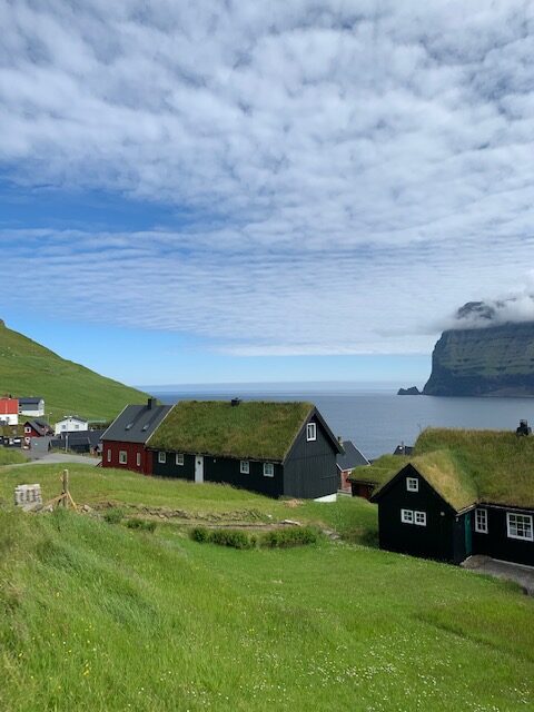

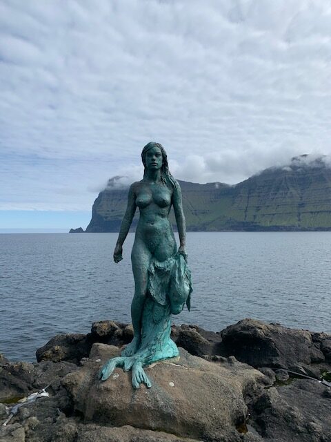

Length: Casual Stroll Through A Village
Time Needed: <1 hour
Fee: None
Mikladalur is a village by the sea made famous by the seal woman statue. There are other points of interests that the small village try to showcase. But perhaps the one that surprised us is the presence of a small puffin colony on the cliff just below the village.
Kellur Lighthouse
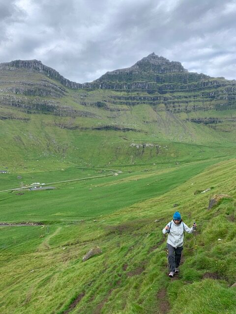

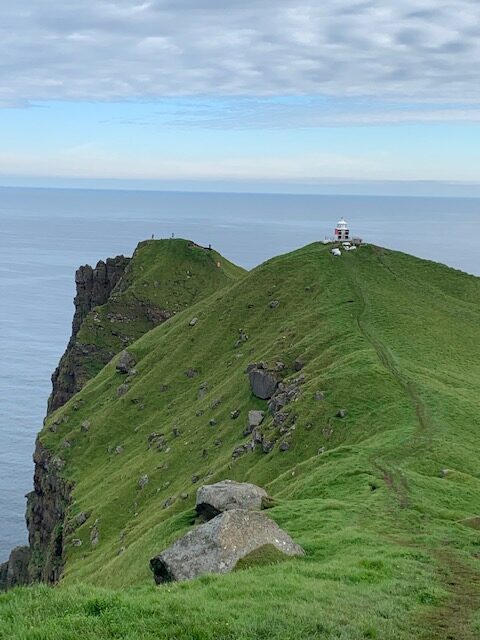

Length: <2 kms one way
Time Needed: 2.5 to 3 hours
Fee: 200 DKK pp
Most Youtube videos identify the Kellur Lighthouse as a must do. We have mixed feelings. Though the hike takes you to nice vistas, you can pretty much get those from a lot of places in the Faroe Islands. The only thing unique is the James Bond headstone in which the locals commemorate the scene in No Time To Die where the character died.
Eysturoy
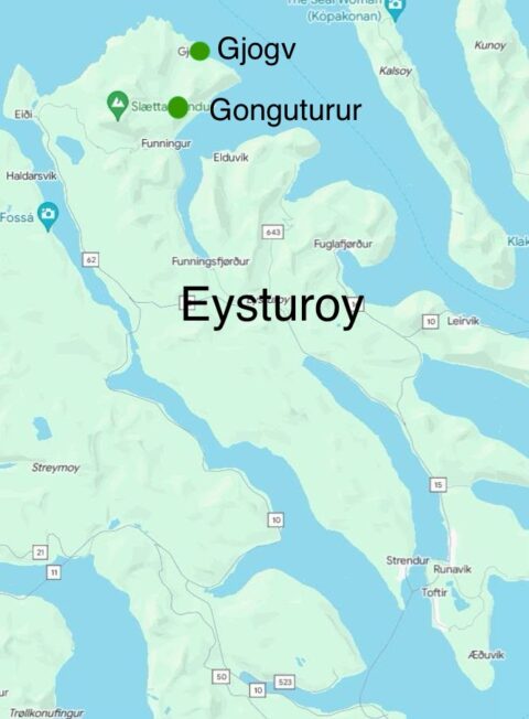

Gonguturur Hiking Route
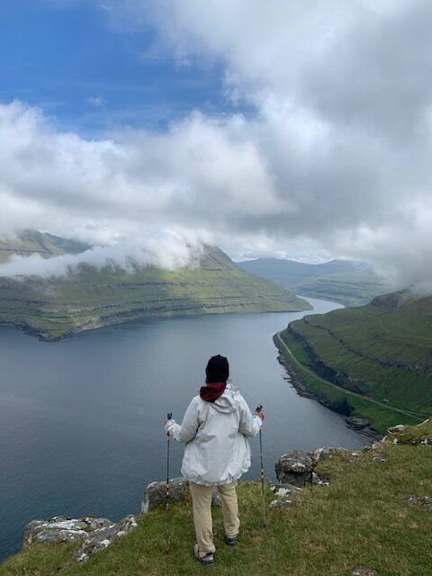

Length: 1.5 kms
Time Needed: 1 hour
Fee: None
The Gongutúrur Hiking Route is quite possibly one of the highlights of any Faroe Island trip. This triangular hiking route first takes visitors to the Hvithamar viewpoint. The viewpoint offers a spectacular view of the fjord and surrounding mountains while being above the sleepy village of Funningur. The trail continues steeply up to to the summit called Sjeggjanøv for an even more spectacular view before returning to the starting point.
Gjógv


Length: < 1 km unless doing the niðan á Barm trail
Time Needed: 30 minutes to 2 hours
Fee: None around the village, 50 DKK for niðan á Barm trail
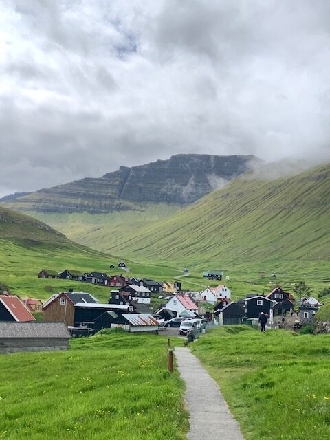
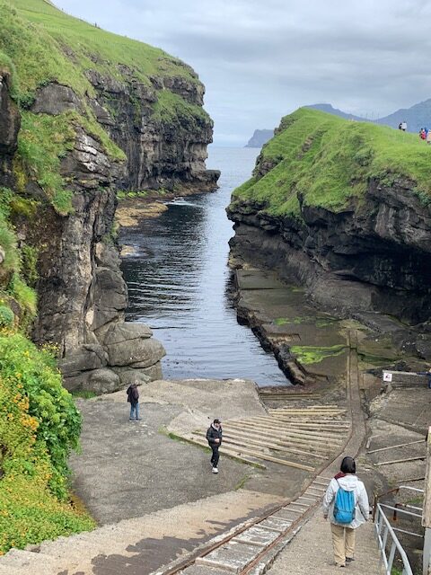
Gjógv means gorge in Faroese. So this small picturesque village got its name because of the gorge located to the north that acts as a natural harbor. The harbor is no longer used but is worth taking a look because there is nothing like it we have even seen.
A popular spot in Gjogv is ‘Crownprincess Mary’s Bench’. It was unveiled in 2020 in honor of Crown Princess Mary’s visit to the area. The bench overlooks the village with stunning views over the ocean and out towards the cliffs.
For us, we spent a long time at the start of the niðan á Barm trail. We did not have the cash at the time so we just spread our ground cloth and ate our sack lunch there while admiring the view of the sea, the greenery, the village and the mountains.
Streymoy
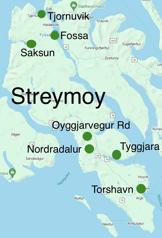

Saksun and Black Beach
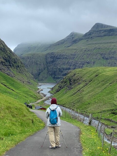

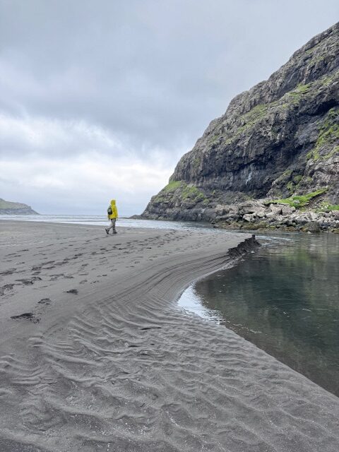

Length: 6 kms round trip (Út á Lónna hike)
Time Needed: 2 hours
Fee: None
The scenery in Saksun is similar to Gjógv in a sense that the village is surrounded by mountains. Unlike Gjógv, there are fewer houses in the village of Saksun. But the main draw of Saksun is the Út á Lónna hike which takes visitors along the bay to the black sand beach. Along the way, you will see Pollurin Waterfall which reflects beautifully on the bay’s surface when still. This hike can only be done during low tide so check the tide times before making any plans.
Oyggjarvegur Road and Norðradalur
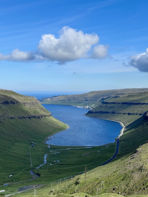


Length: No Hiking
Time Needed: 1 to 2 hours
Fee: None
Perhaps overlooked by most visitors is the Oyggjarvegur Road which runs between the Effo Gas Station and Torshavn. This road takes visitors high up in the mountain providing scenic views of the valleys and fjords below. However, there are very few pull outs.
The small village of Norðradalur makes going on the Oyggjarvegur Road worthwhile. This village is surrounded by mountains on three sides and the ocean on one. The village sits at a high elevation so the road leading to the village provides some spectacular view of the coastline below.
Fossa and Tyggjara Waterfalls



Length: Short walks
Time Needed: 10 to 20 minutes each
Fee: None
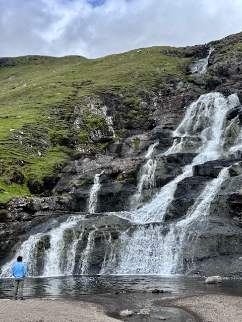
Both waterfalls are located on the side of the road. Fossa is the highest waterfall in the Faroe Islands. Tyggjara is also high but instead of falling, it cascades over basalt rocks on the mountainside. Fossa is on the way to the village of Tjørnuvik while Tyggjara is a short detour from the road going to Torshavn.
Tjørnuvik


Length: 6.4 kms one way (Tjørnuvik to Saksun)
Time Needed: 2 hours (one way)
Fee: None
Tjørnuvik is among the oldest villages in the Faroe Islands. The village faces the open sea and the two sea stacks known as Risin og Kellingin (the giant and the witch). Below the village is a nice black sand beach that is occasionally hammered by good size waves. This makes Tjørnuvik the only place in the Faroe Islands that has a surf shop.
There is a trail that connects Tjørnuvik and Saksun. The trailhead is at the end of Teigagøta Road. We were not able to do the hike during our visit as the fog was clinging to the mountaintops. Nonetheless, the view of the village, surrounding mountains and the sea from the trail is breathtaking.
Old Town Tórshavn


Length: None
Time Needed: < 1 hours
Fee: None
Tórshavn’s old town consists of Reyn and Undir Ryggi which are small neighborhoods of black-tarred houses with white framed windows and turf roofs. Remarkably, people still live and make their homes in these 14th-century houses.
Next to the old town is the marina and the colorful buildings that face it. We were lucky enough to experience an open air food market mid-day on a Sunday and sampled the local cuisine. The lamb stew with mashed potatoes was excellent.
Suðuroy


Rituskor and Asmundarstakkur

Length: 1.5 to 3 kms depending where you start
Time Needed: 2 to 3 hours
Fee: None
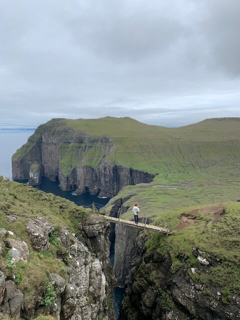
Rituskur is the famous narrow gorge that is connected by a wood bridge. Only one person is allowed on the bridge. Asmundarstakkur is a sea stack that is visible from Rituskur.
The trailhead parking lot is shown on Google Maps and is before the last farm structure where the pavement ends. The road does continue but becomes rocky and bumpy such that it is not suitable for small cars or those with low clearance. You have to open a livestock gate in order to continue on the road. Our Renault Captur rental made it without issues.
It is a steep climb to Rituskur. Midway to the hike, follow the strung wire cable to the bridge. The trail to the Asmundarstakkur viewpoint has a gradual incline.
Famjin
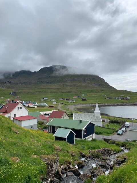


Famjin is a small village by the coast. It is flanked by towering mountains with a couple of waterfalls.
Akraberg Lighthouse


If you want to say you have stood on Faroe Islands southernmost point, then head on over to the lighthouse. The sea cliffs are not bad to look at either.
Just Explore


We found Beinisvord, a gorgeous sea cliff about 8 kms from the lighthouse just by walking up on the grassy mountainside that was not fenced.
Vágar


Mulafossur


Length: 1 to 4 kms approx
Time Needed: 20 minutes to 2 hours
Fee: None
This is probably the most picturesque waterfall we saw in the Faroe Islands. The hike to view the waterfall is less than 10 minutes walk from the village of Gasadalur. There are also puffins nest along the sea cliffs. Just follow the trail that leads to the high point above the village.
Trøllkonufingur


Length: 2.8 kms out and back
Time Needed: < 1 hour
Fee: None
Trøllkonufingur (witch’s finger or troll woman’s finger) is a 313 m (1026 ft) monolith on the southeast side of the island. The trail ends at a viewpoint about half a kilometer from the monolith. Despite the distance, Trøllkonufingur appears near because of its size. The trail is easy and wide on a slight incline.
Trælanípa Cliff & Bøsdalafossur Waterfall


Length: About 6.5 kms
Time Needed: 2-3 hours
Fee: 200 DKK pp
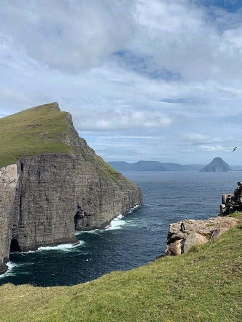
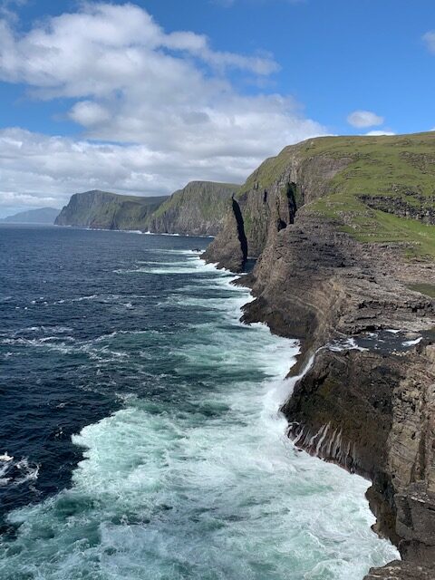
Undoubtedly, this is one of the scenic places in the Faroe Islands. The trail to Trælanípa Cliff & Bøsdalafossur Waterfall is fairly even as it follows the outline of Sørvágsvatn lake, the largest lake in the Faroe Islands. The trail branches near the end. Left would go up to the Trælanípa Cliff viewpoint and right would continue on to viewing the Bøsdalafossur Waterfall and the dramatic southern sea coast. In our opinion, this is the only destination in the Faroe Islands that is worth paying the steep entry fee.
Dunnesdranger

Length: See Alltrails
Time Needed: See Alltrails
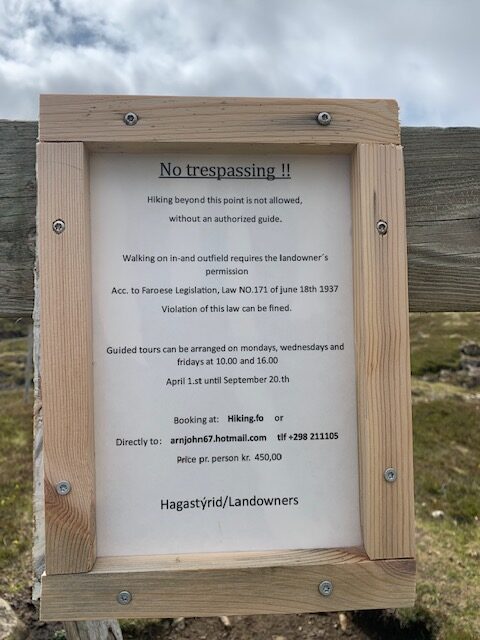
Fee: 450 DKK pp. Need advanced reservation by contacting the owner.
This is a hike through private property that takes visitors to the edge of a cliff to view a couple of monoliths in the ocean. From the Youtube videos and Internet pictures we saw, we included it on our list of destinations. The trailhead is quite difficult to find but by asking a couple of locals and watching the Youtube video by Allan Su, we eventually found the starting point.
Our expedition was cut short by the prominent sign that the landowner put up on the fence that was not there before based on Allan’s Youtube video. We decided not do this hike as the fee and hiking through soggy pasture land did not appeal to us.
Getting Around
Rental Cars
It is highly recommended that you rent a car to be able to see the places listed here in the quickest possible way and on your own schedule. There are buses that go to town and villages but that would tremendously hamper the efficient use of your valuable time. We met a couple of gentlemen that were on a tour group so tour companies do operate here (that is the extent of what we know).
Continuing with the rental car option, you only need a regular car to explore the Faroe Islands. The roads are paved through some are only wide enough for one vehicle, especially those going to Saksun and Tjørnuvik. However, there are occasional pull outs to allow vehicles going the opposite direction to pass.
Rental cars can be quite expensive though. We got ours for about $75 USD per day. There are local car companies that offer lower rental costs but they require an up-front payment during reservation.
We tend to avoid car rental companies that require a deposit, even if it is refundable, for two reasons. First, we find it painfully difficult to get the deposit back. Second, if we find a better deal later, we could not immediately reserve it until we get our deposit back from the other rental car company.
So our advice is book only cancellable car reservations without penalties or deposits but continue to look for better deals as your trip gets closer. This way, you always have a car reservation in your pocket and can book a new reservation if you find a better deal later.
Tunnels
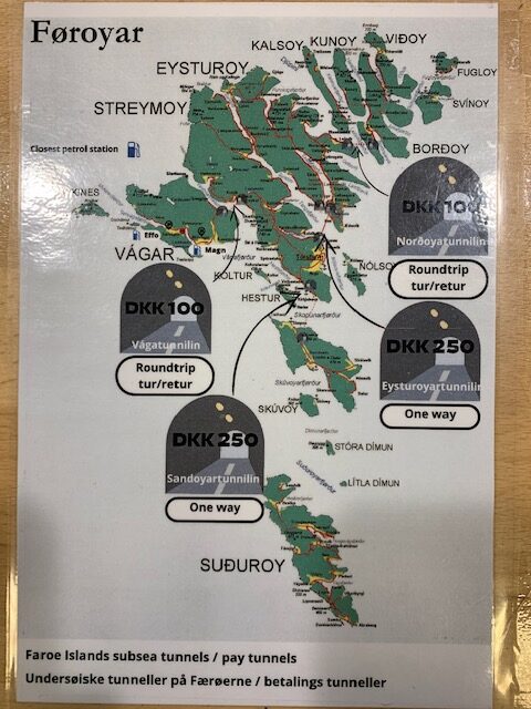

There are two kinds of tunnels in the Faroe Islands, those that are free and those that charge a toll. There are only four toll tunnels and those go under the sea to connect the islands. These are:
Vágatunnelin – connects Vágar and Streymoy Islands. Cost 100 DKK roundtrip
Sarðoyartunnilin – connects Streymoy and Sanðoy Islands. Cost 250 DKK one way
Eysturoyartunnilin – connects Steymoy and Eysturoy Islands. Cost 250 DKK one way
Norðoyatunnilin – connects Eysturoy and Borðoy Islands. Cost 100 DKK round trip
Ferry Boats
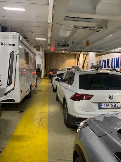

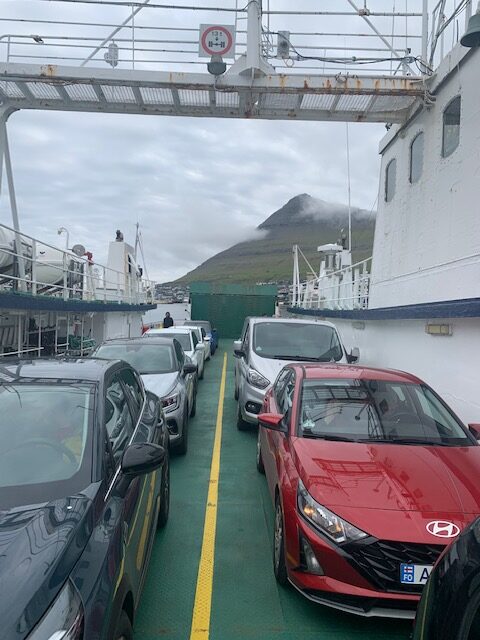

There are two ferries that visitors will most likely use These are the ferries between Torhavn on the Streymoy Island and Tvoroyri on Suðuroy Island and between Klaksvik on Borðoy Island and Sydradalur on Kalsoy Island.
These ferries are reservable on-line and have limited space and sailing times. It is highly recommended to book the ferry ride you need as soon as you know when you are going to need it. Waiting the last minute may result in having no available space on the ferry boat on the date and/or time you want to go.
The ferries are operated by Strandfaraskip Landsins (ssl.fo), the government agency for public transport in the Faroe Islands. It runs seven ferry routes and a number of bus routes.
Weather
Weather in the Faroe Islands is really unpredictable during the nine days we were there. Though there may be weather forecasts, they are sometimes not accurate. The weather from island to island and within an island also varies. It was raining in Tórshavn (accurate forecast) but was partly cloudy in Vágar (inaccurate forecast). On some days, you may have to ignore the weather forecast and drive to your destination to find out what the weather is like.
With regards to clothing, layering is probably the best. Definitely you will need a windbreaker or rain jacket as there will be days when it is windy and/or drizzling.
Suggested Itinerary
There are many ways you can explore the Faroe Islands. For our case, we chose to stay near Tórshavn for nine days and drove to the places we wanted to see. It felt like being at home and was definitely relaxing except when we had to make the drive to Borðoy and Viðoy Islands which turned out to be a long day.
If we were going to do it again, we would go with the itinerary below:
Day 1 – Arrive in Faroe Islands. Stay in Tórshavn. Explore old town Tórshavn.
Day 2 – Explore Streymoy Island attractions
Day 3 – Ferry and day trip to Suðuroy
Day 4 – Explore Eysturoy Island attractions. Try to see Klaksvik.
Day 5 – Drive to Vágar Island and see its attractions. Stay in Vagar.
Day 6 – Fly out.
We took out going to Kalsoy in the itinerary as the sights there no longer had the “wow” factor after seeing Suðuroy. Plus it is not worth the ferry cost and the Kellur Lighthouse hiking fee. If you can spend an extra day, we would recommend staying overnight in Suðuroy to have more time exploring this island.
Similarly, Borðoy and Viðoy are not included in the itinerary since you will definitely feel to be Faroed-out after seeing the other places. If you think you still would have the energy to explore these two islands, then the itinerary can be extended by one day and an overnight stay in Klaksvik.
The above itinerary does not have allowance for any foul weather day that might keep you indoors.
Summary
The Faroe Islands is a remote archipelago located in the North Atlantic Ocean, midway between Iceland and Norway. It comprises 18 islands, 17 of which are inhabited. The islands are characterized by rugged cliffs, dramatic landscapes, fjords and sounds. The islands are mostly covered by grass which makes it lush and verdant in the spring and summer. With the absence of trees, there are many unobstructed spectacular views.
There are eight islands that visitors typically visit. These are Borðoy, Kalsoy, Eysturoy, Sandoy, Streymoy, Suðuroy, Vágar and Viðoy. We did not visit Sandoy as we could not find anything interesting on the Internet and our host did not enthusiastically said we should go there. We would also take Borðoy, Kalsoy and Viðoy off the list for reasons earlier mentioned.
Whichever island or attraction you end up visiting, the Faroe Islands will surely provide a unique experience and provide lasting memories.

