This is the second part of a three part write-up about our experience on doing the Camino Portugues Coastal Route from Porto. The first part talks in general about the Camino Portugues Coastal Route from Porto. This part talks about the path we took. The third part lists and describes our accommodations along the way. We encourage you to read the first part first before continuing to read this blog.
We spent 12 walking days and one rest day on the Camino Portugues Coastal Route from Porto. We did this camino during the second half of March 2023 and arrived at Santiago de Compostela on March 31st. We describe here the path we took, the distance covered each day and the time it took us to cover that distance. If you are going to plan your camino based on the information contained here, we suggest you mark your waypoints on Google Maps as you read this blog. Waypoints can be created using its “Save” feature.
The Way
I describe the way or the path that we took as if looking at Google Maps aerial view. It would be better if you have two screens, one showing this article and the other showing Google Maps. This way you can follow along easilty without having to switch screens.
Day 1, Porto to Labruge, about 24 kilometers. Total time 6 hours including about 30 minutes of stops.
The official start of the Camino Portugues is from the Porto Cathedral. This is where we also obtained our credentials or the passport to collect stamps to present at Santiago de Compostela to get our completion certificates.
We made our way to the McDonalds on the banks of the Douro River across the Igreja Monumento de Sao Francisco. Then we just walked on the left side of the street of Rua Nova de Alfandega which changes names along the way until the river meets the ocean. Then we turned north walking on the left side or Rua Cel. Raul Perez which changes name to Ave. do Brasil later. We just walked on the trail shown on Google Maps until we reached the Rotunda da Anémona that has a massive circular hanging artwork.
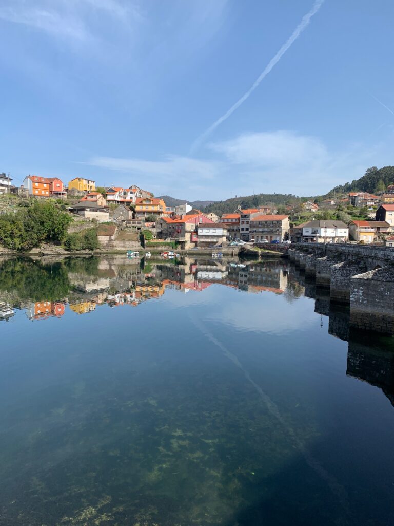
We are now in the city of Matosinhos. We took the city streets inland after the rotunda and made our way to the Ponte móvel de Leça which is a drawbridge. We were unfortunate and lucky at the same time to have been at the drawbridge when there was a cargo ship passing by. We had to wait about 20 minutes (unfortunate) for the ship to pass but also witnessed the bridge being swung open to the vertical position (fortunate). It was an impressive sight.
Past the bridge, we saw our first camino sign directing us to either turn left or go straight. We turned left and headed to the coast. Along the way we collected our first stamp from a local store that had a sign on the outside stating that they stamp camino passports.
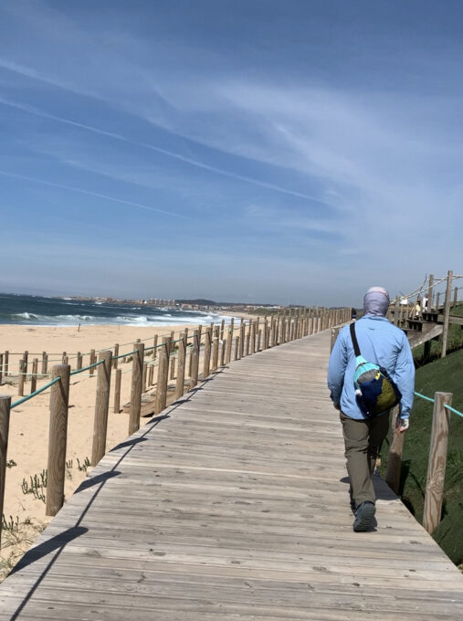
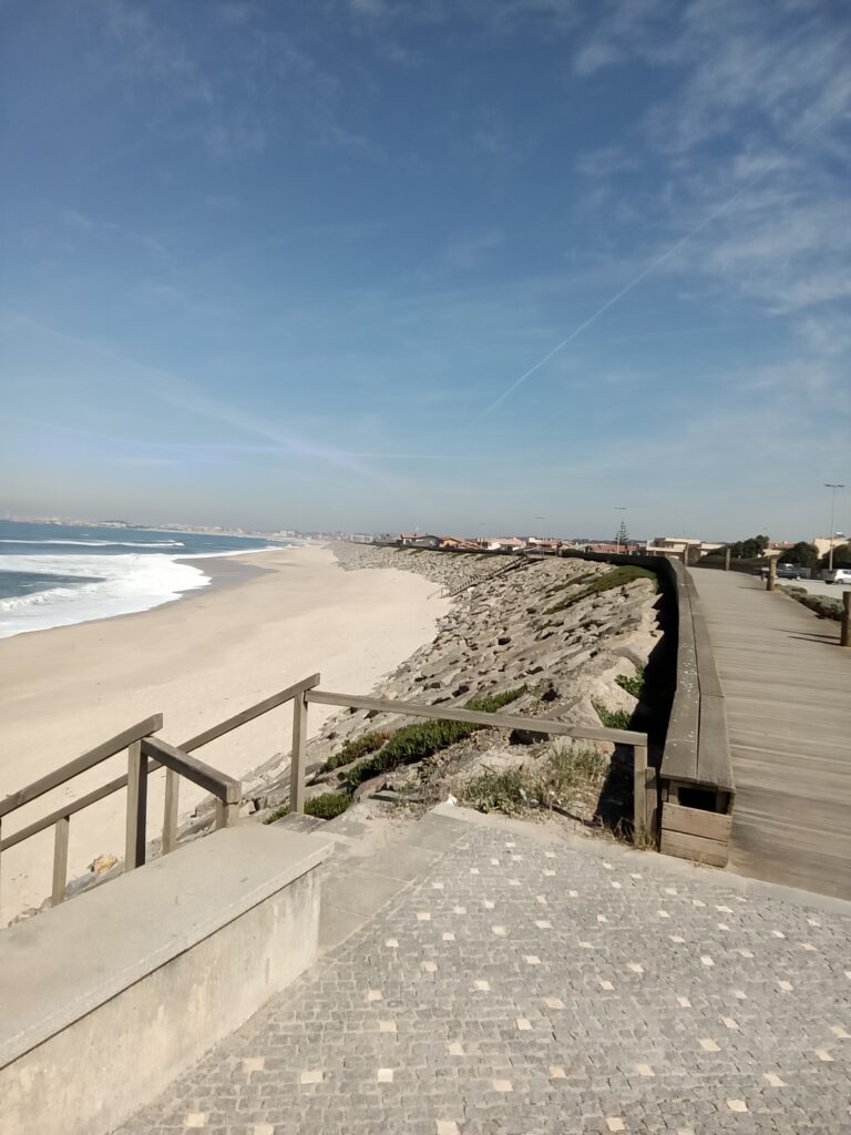
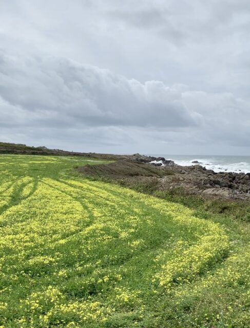
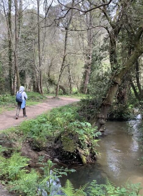
The rest of the way was either through boardwalks or compacted sand with the ocean just a stone throw away on our left. There were painted yellow arrows along the way showing the path, as well as other peregrinos walking.
Day 2, Labruge to Apulia, about 27 kilometers, total time 6 hours without stops.
Arlyn’s cold was worsening so our previous night’s host drove her to our accommodation in Apulia. I went solo. This was probably the longest stretch of boardwalk on the entire journey. It offered some nice views as well. You can actually zoom into these boardwalks on Google Maps. In some places, these boardwalks were taken over by the shifting sand dunes.
I headed west towards the coast to Restaurant O Banheiro. The boardwalk is just north of the restaurant. It hugged the coastline. The boardwalk transitioned to streets in the towns and cities like Facho, Bairro da Louça, Caxinas and Póvoa De Varzim.
The boardwalk turns inland north of Barranha where it goes in between a golf course on the left and farmlands on the right. Then it went through some wooded area which was a welcome relief from the sun. At about 2 kilometers from the main town of Apulia, the boardwalk ended and I had to walk on paved and unpaved roads using Google Maps for directions to get to our accommodation.
Day 3, Apulia to Viana do Castelo, about 30 kilometers. Total time 7 hours, 10 minutes without stops.
Arlyn was still not feeling well so she took the bus to get to our accommodation. This was the hardest leg of the journey mainly because I got lost trying to stay near the coast while following a large scale map we took a picture from a guidebook.
From Apulia, it was fairly easy going to Esposende. The path followed Avenida Madrigal Cedovem for about 1.5 kms until it met Rua Sao Joao de Deus where it veered inland until it hit Highway N13 in the town of Fao. .
I turned left past the bridge to get near the coast and walked alongside Ave de Banhos until I reached the south end of Ecovia Litoral Norte, a nature preserve that has walking paths. According to the nature preserve sign, there is a walking path that hugs the coastline all the way to the border with Spain. This was consistent with the map from the guidebook we were using. Behind the nature preserve is a boardwalk that goes into the forest. However, below the nature preserve sign, affixed to the curb is a camino sign showing an arrow to turn right and follow the road.
I went for the boardwalk thinking it would meet up with the camino path based on the information shown on the nature preserve and the map on the guidebook. The boardwalk ended at the Parking Praia de Rio de Moinhos about 1.5 kilometers later, at the village of Monte. There was no camino sign anywhere and the peregrinos I was following somehow disappeared.
Now I either had to find the trail shown on the nature preserve map or head inland and try to find the camino path. Looking at the Google Maps aerial, I would run into the Rio Neiva about 3 kilometers north if I tried to stay near the coast. That meant I have to turn inland and follow farm roads that look like convoluted tree branches on the map to get to the bridge closest to the coast.
Lucky for me, I ran into a Frenchman who was vacationing and quite familiar with the area. He walked me to the town of Belinho where I got back on the official camino trail on R. Padre Almeida just east of Highway N13. He said, further north, at the end of the village, I can turn right and go through villages (Option A) or I can turn left and follow road N13-3 (Option B) to get to Viana do Castelo.
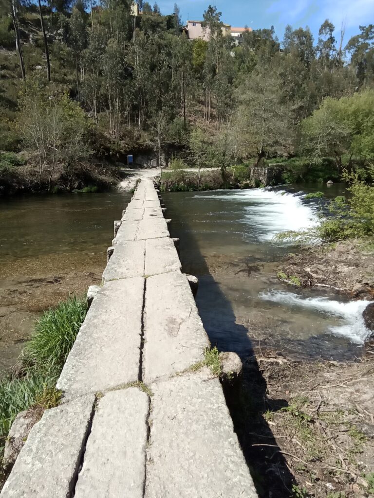
At this point, walking along the coast is no longer an option. Having lost some time by getting lost earlier, I took option B (N13-3) because it looked shorter on the map. I got on R. Foz do Neiva after crossing Highway N13 despite seeing some camino signs that pointed to take option A. Then I just followed the Google Maps walking directions. It first took me through local streets, then unpaved roads and then a trail until I reached the pedestrian-only stone bridge Ponte do Sebastiao that crosses the Rio Neiva.
To my surprise, there is a camino coastal route sign at the other end of the bridge. How confusing because I saw a camino coastal route sign about 2 kilometers back telling me to turn away from Highway N13-3.
I followed the sign until I was again on paved streets somewhere in the town of Castelo do Neiva. I even got a stamp at Albergue Dom Nausti. I did not see a camino sign past Castelo de Neiva so I just followed Google Maps until I reached our accommodation in Viana do Castelo.
Reflecting back at it, I should have followed the camino signs north of Esposende and accepted the fact that I would not be walking alongside the coast on this leg of the journey.
Day 4, Viana do Castelo to Vila Praia de Âncora, about 20 kms. Total time 5 hours without stops.
This was probably the easiest and most enjoyable leg of the journey. Arlyn was feeling better. We walked along the coastline majority of the time. We walked on a series of paved, compacted dirt and boardwalk all the way to the pedestrian only bridge that crosses the Rio Ancora just before reaching the town of Vila Praia de Ancora.
What we did this time is we studied Google Maps aerial view the night before and traced our path to our destination. It worked well. We knew where to turn so we did not get lost. If we deviated, at least we knew where the trail or the path was headed. Camino signs were few and far in between. We only saw four other pergrinos on this leg. We only looked on Google Maps to know where we where.
From our accommodation, we headed towards the coast until we hit Marginal street. We then turned north walking alongside Marginal street until it dead ended at a roundabout. We continued north on a pedestrian only path that was initially paved, became compacted dirt and turned into a boardwalk until we reached the Areia Restaurante Bar.
We walked on the local street north of the bar until we reached the Monumento Natural do Alcantilado de Montedor where we encountered the Trilhos de Carreco. Trilho means trail in Portugues and if you look at aerial Google Maps, you can see the faint trail at this location. Naturally, we took the trail that led us to Praia do Paçô. We walked on the beach for about half a kilometer until we decided it was too slow going so we went inland when we saw a boardwalk to our right.
That boardwalk led us to a parking lot where we were able to pick up the cobbled road Camnihodofial. The road ended about 2 kilometers later. To our left was a boardwalk and straight was a trail. We took the trail and it led us on top of Praia do Forte do Cão. There we took the boardwalk to the pedestrian only bridge that crosses the Rio Ancora just before reaching the town of Vila Praia de Ancora.
Day 5, Vila Praia de Âncora to Portecelo, about 20 kilometers. Total time 6.5 hours including waiting for the water taxi and an hour lunch at A Guarda.
It rained the entire day and the wind was blowing so we were soaking wet. This would have been an enjoyable leg if it wasn’t for the bad weather.
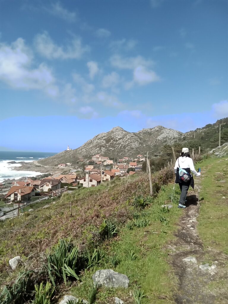
We started the day by walking along Ave Camp do Castelo from our hotel at Vila Praia de Âncora. About a kilometer later, the road turned right while the camino sign directed us to continue straight and stay on the walking path. At Capela Santo Isidro, the path splits, one straight and the other going to the left towards the ocean. Both will meet further so we just turned left to be by the ocean.
We saw a camino sign with an arrow directing us to go through a tunnel under the railroad upon reaching the south end of the town of Moledo. We asked a local and she said that it is better to not take the tunnel and instead continue on our path and go through the forest preserve.
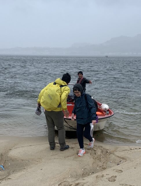
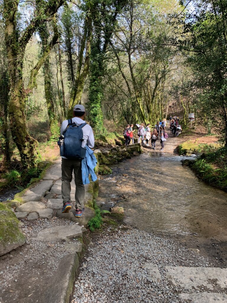
There were yellow arrow signs that guided us to take the dirt forest preserve road that ends at the water taxi pick-up point. Initially, we were hesitant when we got to the road as it had a sign stating that it is for limited access. Probably because there are people that sometimes thin the forest so it becomes a safety concern. It was raining and we did not see or hear any chainsaws so we went and had no issues until we got to the water taxi pick-up point. The water taxi pick-up point is shown on Google Maps if you zoom in closely.
Water taxis are basically fishermen that use their boats to shuttle peregrinos. Our water taxi driver even had a stamp. He said that there are only two of them shuttling peregrinos during low season. During the high season, they have five fishermen shuttling peregrinos. Cost was 6 Euros per person and it took less than five minutes to get to Spain.
There is no boat dock on the Spain side. Our water taxi operator just beached the front of the boat on the sand and we jumped off just like soldiers storming the beach of Normandy during D-day. He instructed us to go left until we saw the yellow arrow sign directing us to a boardwalk which transitioned to a sidewalk alongside Avenida Fernandez Arbor. We walked on the sidewalk until we reached the town of A Guarda.
We took the pedestrian-only footpath At Praia do Porto in A Guarda and continued to hug the coastline until the footpath ended at Rua Baixada a Praia. We walked along the road until Praia de Fedorento where the arrows directed us to turn left and part with the road to stay near the coast. Not long after, we saw our first Galicia monument sign telling us we are 160.26 kilometers from Santiago de Compostela. From then on, Galicia monuments are abundantly placed on the trail that it would be impossible to get lost. We did not need our smart devices from then on.
Past an abandoned house by the ocean, the sign directed us to go inland towards highway PO-552. Just a few feet from the highway, another sign directed us to turn to Ono do Estrada Vella which later ended at the highway. We could have taken the highway from the start as it had a foot/bicycle path wide enough for three people without being shoulder to shoulder. We just then followed the camino signs until we reached our accommodation.
Day 6, Portecelo to Sabaris (Baiona), About 26 kms. Total time 7 hours.
The first half of the leg is either walking on the west side of Highway PO-552 or local streets that parallels the highway. These local streets are either to the west or east of the highway depending on where we are on the walk. For sure though, the local streets meet up with the highway down the trail. Sometimes it is just better to stay on the highway if there is a pedestrian walkway. It seems that the signs directed us to take the local streets to be safe and away from fast moving vehicles and to also go through villages which may have a shrine, chapel or similar point of interests. For the purist, always follow the sign even if it is longer or has an elevation difference.
The second half of the leg leaves PO-552 and goes through the mountain at around 137 kilometers left to go to Santiago de Compostela. The path goes through the forest and then on local streets as it descends down to Baiona. Camino signs are often enough such that smart devices for navigation are not needed. The path in Baiona goes through circuitous streets and involves elevation changes such that it is tempting to just stay on Highway PO-552.
Day 7: Sabaris (Baiona) to Alcabre (Vigo), about 16 kms. Total time 5.5 hours.
It seems the rigor of walking all day for the past six days is taking its toll as we find ourselves getting slower and more tired at the end of the day. And catching a cold made it worse. Spending an extra day in Alcabre to give our feet and legs a rest was a welcome relief.
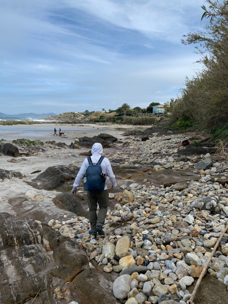
We just headed to the Highway PO-552 bridge that crosses Rio Minor when we left our hotel. Across the bridge we saw green and yellow arrows directing us where to go. The route is a mixture of going through towns and walking by the beach like we did at Praia Americana. We had to double back a little bit at Praia Americana because we failed to see on Google Maps that there is a river we could not cross unless we double back and got on the boardwalk.
At the Prado Surf Escola Patos (surf school), we followed the arrows that directed us to go on a dead end road. We had to go down the beach at the end of the road and walk less than 100 feet to continue on Rua do Caranquexo. It was a good thing that it was low tide and we were able to walk on the beach. We saw the rocks on the beach being wet suggesting that the area is under water during high tide.
The rest of the walk was just following the directional arrows while walking on the side of the road until we reached Alcabre.
Day 8. Rest day at Alcabre.
Day 9. Alcabre (Vigo) to Redondela. About 20 kms. Total time 6.5 hours
The coastal path ends at Vigo and turns inland. The traditional route north of Vigo is to go through the mountain which is what we did. It may be harder on the knees, but at least it is shaded going through the forest until the trail descends down to Redondela.
From the hotel, we crossed the street to walk on the coastal promenade which ended shortly. We just followed the yellow arrows which took us alongside the water. The directional arrows sort of disappeared past the VG-20 bridge but we just continued on Avenida da Beiramar which passed by the shipyards on the left. We did not see any camino signs but passed by a small coffee shop that stamps pilgrim credentials. Must be the right path.
Our waypoint was the Monumento a Jules Verne which is a statue of Jules Verne sitting on an octopus. After the Jules Verne statue, the camino monument once again appeared showing we have 102.110 kilometers to go. We did not see any other camino signs until we reached Rua de Sanjurjo Badia. This long, narrow and gradually uphill street has camino directional arrows on business establishment windows. We continued on Rua de Sanjurjo Badia until it became Avenida de Galicia. We turned right on Camino Xorxa from Avenida de Galicia. There we met an older gentleman telling us to go back down and continue on Avenida de Galicia if we want a less demanding, knee friendly route. We said we want to go through the mountain and follow the original route so the older gentleman bid us “Buen Camino”.
After crossing over Highway AP-9V, the street ascended to meet N-552 where we followed it to the town of Chapela. We turned right on Camiño Ronchal just before Farmacia Pereiro Alvarez (we could have turned right also after the pharmacy on Camiño Mouriño). Then we got on Camiño da Rabexa before taking Camiño da Traida. Here the streets are steep as we ascended.
The Galicia camino sign once again turned up on Camiño da Traida as it transitioned into a dirt road. The sign showed that we have 95.04 kilometers to go. Here the dirt road is fairly level as it went through the forest. We passed “Graffiti Pez” (shown on Google Maps) which is a rock painted to look like a parrot fish. We followed the mostly shaded dirt road for almost 6 kilometers until we reached the Galicia camino monument that shows we have 89.86 kilometers to go.
We are now at the outskirts of Redondola and the dirt road became asphalt as we descended steeply. It was a little hard on the knees (would be harder if we had a heavy pack). The camino signs were plentiful and there was no guessing where to go until we reached our accommodation in Redondola.

Day 10: Redondela to Pontevedra. About 21 kilometers. Total time 6 hrs.
There was no guessing today on which road to take because the camino signs were abundantly placed that there is no chance of getting lost. We hardly used Google Maps to find our way.
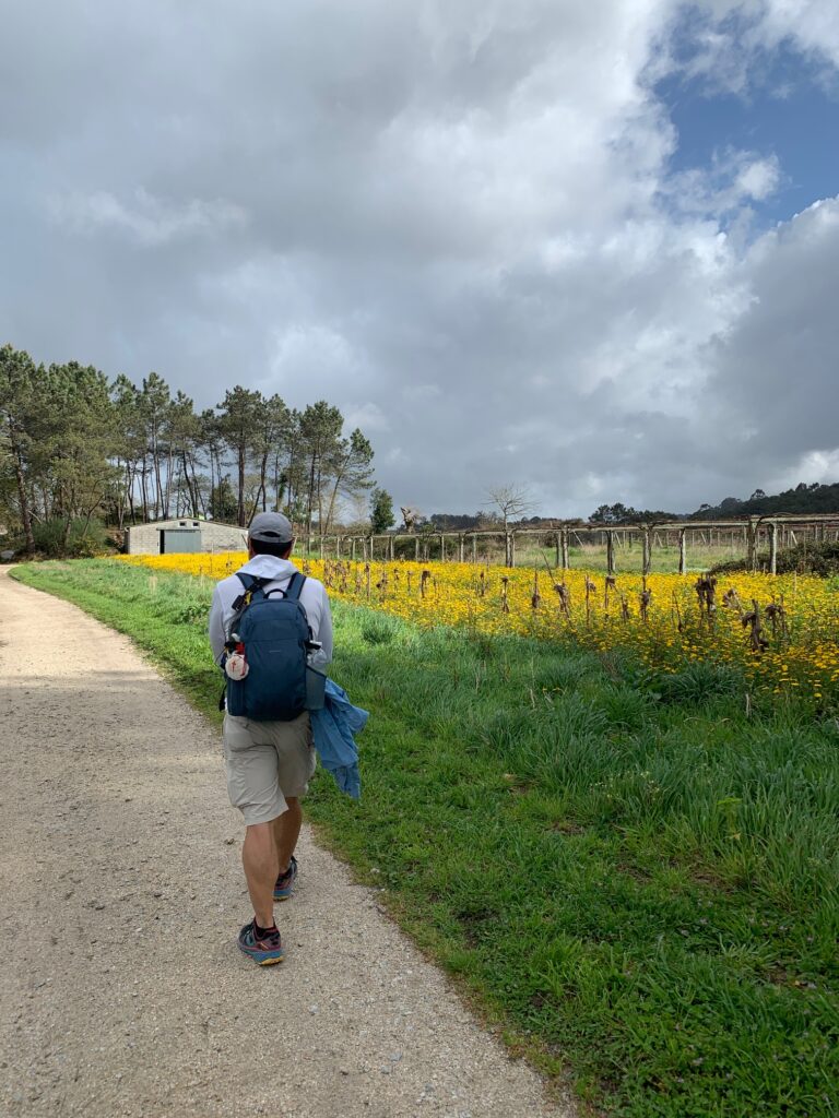
From our accommodation, we continued on Rua Xeneral Rubin and turned north on Avenida Sta Maria where we picked up the camino signs that showed we had to walk to Rua Campo de Futbol. From there we just followed the signs that took us through farmlands, forest and villages. At the town of Arcade de Riba, the camino signs had us cross the main road to take a side street then had us crossing over the same road to the side we were on in earlier. We could have simply continued on the main road in the first place. Guess it wanted us to go past a water fountain that was filling a couple of small pools.
We had to take a little detour in Arcade de Riba when we encountered the street that was closed due to construction. We eventually ended up at the bridge Ponte Medieval de Pontesampaio. It was an uphill walk through the village after the bridge. Once we were out of the village, then we went through woods and farmlands while still continuing to ascend.
There were two directional arrows at camino kilometer sign 71.465. One had an arrow pointing to the left indicating a complimentary route while the other pointed straight to continue on the road. A couple of pilgrims said the complimentary route is prettier so we turned left. As it turned out, the path was parallel to the stream for about 5 kilometers until we reached Ponteverde. It was nice walking on dirt instead of pavement and had shade most of the time.
Day 11. Pontevedra to Caldas de Reis. About 21 kms and 5.75 hours.
We picked-up the trail at the Ponte do Burgo pedestrian only bridge in Ponteverde. The Galicia kilometer sign shows 65.92 kms to Santiago. Trail signs were abundant and we did not have to pull out our smart devices.
The path mainly went through small villages, farmlands and forest.
Day 12. Caldas de Reis to Padron. About 19 kms and 5 hours.
We got confused by the camino sign that told us to turn left after the Ponte Romana do Rio Bermanna bridge on Rua Real. It was a good thing that we ran into a perigrina from Genova, Italy who was following her map on her phone. It turned out that we should just went straight on Rual Real. Then we started seeing the camino signs not long after the bridge. The first Galicia monument we saw showed 44.217 kms to Santiago. We also did not need our GPS today as the camino signs were abundantly placed to direct us where to go.
The path went through the forest and besides farmlands for the majority of the time. There were some elevation gains but not very long or steep. There was a long stretch of dirt road through the forest after the town of Valga.
Day 13. Padron to Santiago de Compostela. About 24 kms and 7.5 hours.
From our accommodation, we went to the Igrexa de Santiago Apóstolo de Padrón to get stamped. From there, we followed the camino signs that took us through villages. We emerged on HIghway N550 and passed by Hotel Scala before again taking the side streets through villages.
There was a police detour sign that made us go back to Highway N550 so we lost the camino signs. I asked a local and she said just continue on walking north on the highway. The camino signs again reappeared just before reaching Igrexa da Escravitude where we got our second stamp for the day. Then it was just following camino signs that took us through forests, fields and villages until we reached O Milladoiro where we checked in at our accommodation.
Our original plan was to stop at O Milladoiro and have a short day the following day to finish the camino. But the desire to finish because we were so close gave us energy to continue. So we left whatever we did not need at the accommodation and walked to the O Milladoiro town proper to pick up the trail. By then it was slightly just over 9 kilometers more to go.
The signs were plentiful and the path took us through forest and villages before coming to a decision point where we had 3 kilometers left to go. There were two Galicia markers. One pointed left which was the Por Santa Maria route and the other marker pointed right which was the Por Conxo route. We were told by the young polish guy who was told by somebody else that the right is the traditional but longer route. We went right. The last sign we saw was by a Parroquia de la Mercé de Conxo. From there on we relied on Google Maps to get us to the Cathedral of Santiago de Compostela.
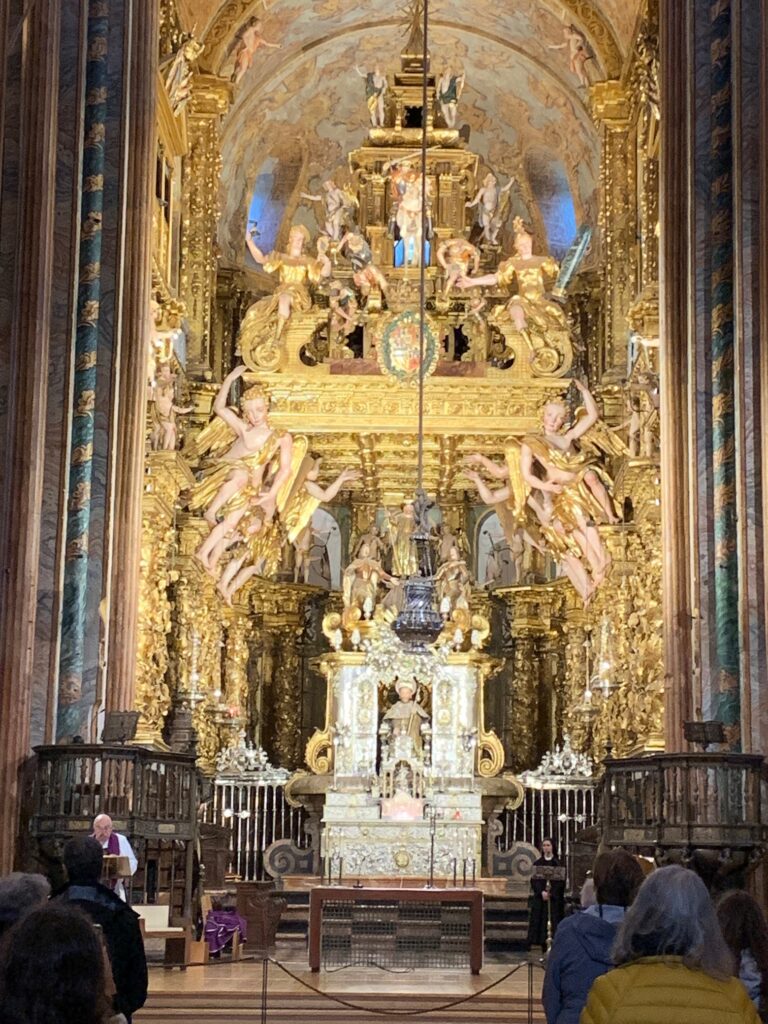
We asked for directions on where to get the certificate and they pointed us to a street to the left of the hotel that is adjacent to the cathedral. On Google Maps it is labeled Pilgrim’s Reception Office or Oficina de Acollida ó Peregrino (Santiago de Compostela). The office closes at 7PM.
Summary
The Camino Portuguese Coastal Route from Porto is a relatively short walk compared to other caminos. Some people who want to make it shorter start from Vigo because it is at least 100 kilometers from Santiago de Compostela.
From Porto Cathedral, we made our way toward the Douro River and followed it West until we hit the coast. We then turned north and hugged the coast unless we had to cross a river where we had to veer inland to the closest bridge. South of A Guarda, Spain, one may have to rely on on GPS navigation as the signs are few and far in between. North of A Guarda, the Galicia markers are frequent enough such that GPS navigation is not needed, except at towns and cities.
Having waypoint markers on Google Maps helps in GPS navigation. Waypoint markers can be easily added using its “Save” feature. Studying the path for the day’s walk in Google Maps aerial view also helps in avoiding any surprises and getting lost.