
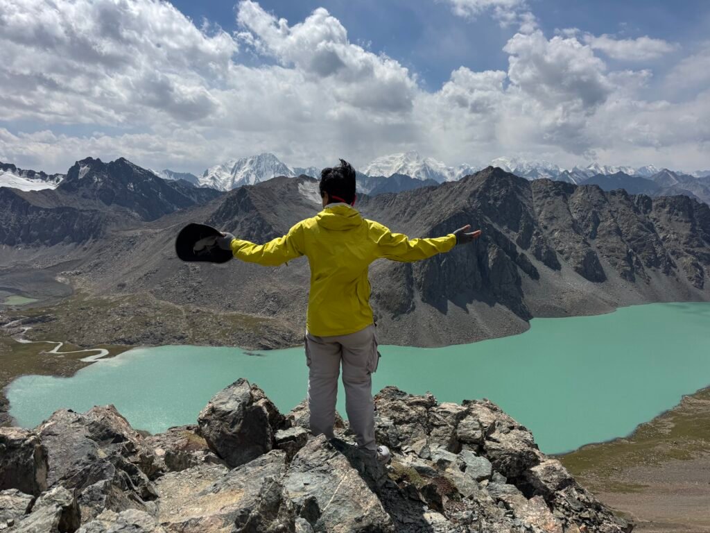
Image: The view at Alakol Pass, Kyrgyzstan.
Highlights
Detailed description of two day hike from Karakol to Altyn-Arashan through Alakol Pass in Kyrgyzstan.
Date of Visit; Mid August 2026
Duration of Visit: Two Days
Description
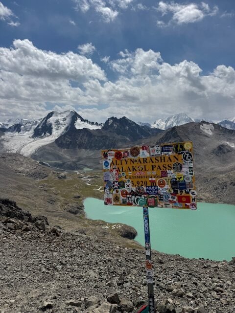
Doing an overnight hike between Karakol and Altyn-Arashan through Alakol and Alakol Pass is one of the most popular tourist activities in this part of Kyrgyzstan. This adventure is not to be taken lightly. Alakol Pass sits at 3,920 m (12,858 ft). It is a very demanding hike. But the reward is well worth the effort. Besides having the bragging rights, sitting at the pass gives you the feeling of being on top of the world.
The route can be done either clockwise or counter-clockwise direction. I did it in a counter-clockwise direction that started in Karakol and ended in Altyn-Arashan. In my opinion, this was the better direction mainly because of the steep climb to the pass coming from Altyn-Arashan. Trail switchbacks are few in either direction. Krygyz prefer the direct approach which is straight up. It is common to encounter inclines at 45 degrees and steeper. Your legs will feel it and so do your lungs. Preparation is key especially if you do not have young legs like me. Otherwise, you might feel like you are dying out there.
The total hiking distance depends on where you begin. From Karakol, the common starting point is the first bridge which is about 5 km (3 mi) after the park entrance. From the first bridge to Altyn-Arashan is 29 km (18 mi). I took the public transportation (marshrutska) where I got dropped off about a 1.6 km (1 mi) from the park entrance.
Activities
Hike Overview
Below is a detailed hike description presented in segments. The majority of the information was taken from the Tourism Development board posted at Altyn-Arashan, All Trails and Maps.me. The times shown do not include resting times at Alakol and Alakol Pass which were the only two stops where I took more than five minute rest.
| Leg (destination elevation, m) | Distance, km (mi) | Elevation Gain/Loss, m (ft) | Time, Tourism (mine) |
| Karakol (last marshrutka stop) to First Bridge (2106) | 6.4 (4.0) approx | 122 (400) approx | n/a |
| First Bridge to Second Bridge (2530) | 9.8 (6.0) | 424 (1,391) | 4:00 (2:20) |
| Second Bridge to Sirota Yurt Camp (2960) | 3.2 (2.0) | 430 (1,410) | 1:30 (1:40) |
| Sirota Yurt Camp to Alakol (3532) | 2.5 (1.5) | 572 (1,876) | 2:30 (2:25) |
| Alakol to Alakol Pass (3920) | 2.5 (1.5) | 388 (1,273) | 2:30 (2:20) |
| The Pass to River Crossing (2995) | 5.8 (3.6) | -925 (-3,034) | 3:00 (2:30) |
| River Crossing to Altyn-Arashan (2525) | 5.2 (3.2) | -470 (-1,542) | 2:00 (1:25) |
Karakol to First Bridge
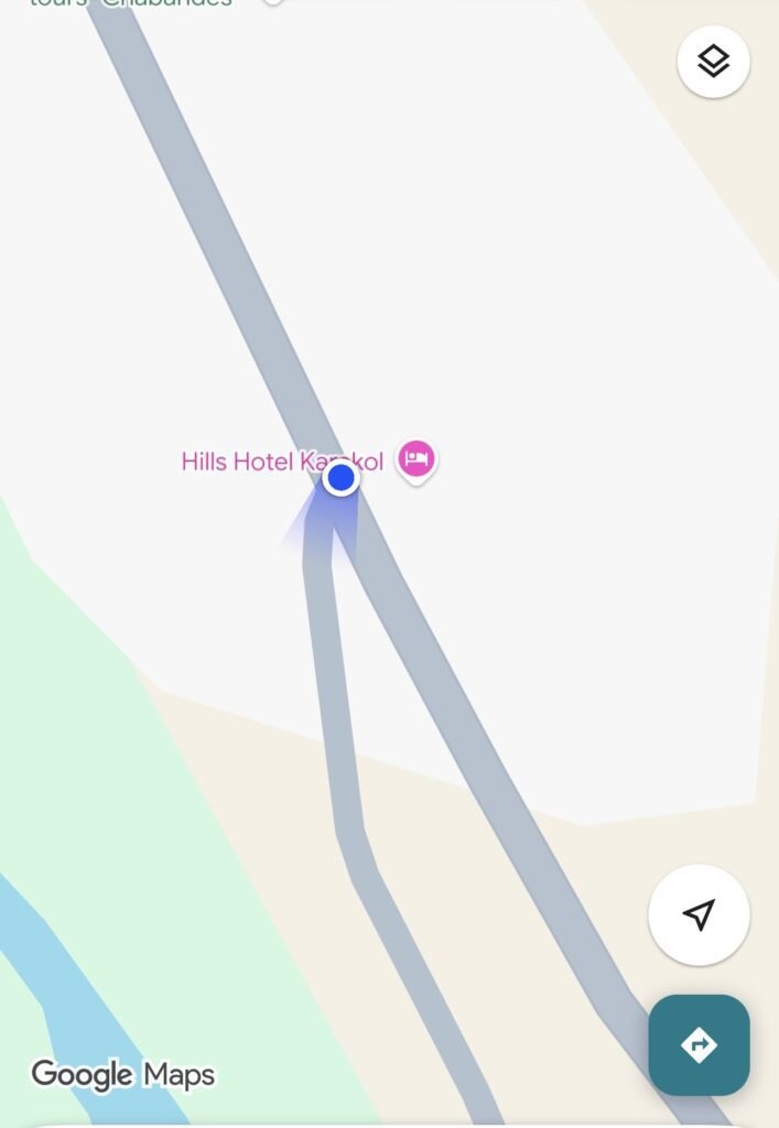
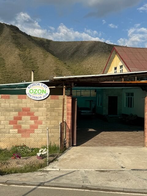
I took the marshrutska 101 which starts at the southeast corner of Toktogula and Jusaev St in Karakol. The bus stop is right beside the latte shop on the south side of Jusaev St. The marshrutskas last stop was in front of Ozon Guest House which on Google Maps is shown as Hills Hotel Karakol. I walked on the sidewalk on left side of the street until reaching the park gate.
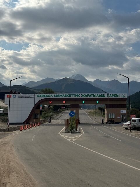
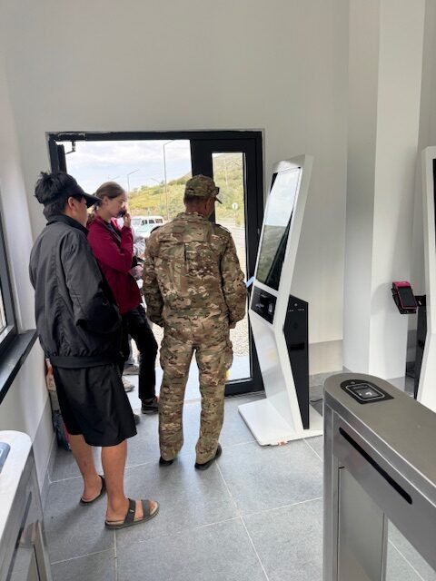
The ranger called me over to pay the entrance fee. I caught a ride on a 4×4 shuttle that was taking three other hikers to the first bridge. About half a mile after the park entrance, the shuttle turned right into a rough road on the way to the first bridge. It was a bumpy ride.
First Bridge to Second Bridge
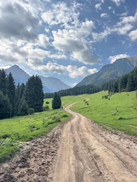
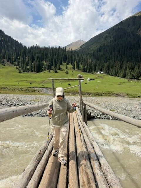
This section of the hike was on a rough road. The road parallels the west side of the Karakol River. It was a gradual incline most of the way. There were short steep sections but nothing that would bust your lungs. There were a few vehicles that passed by that took hikers to the second bridge. There were two water crossings but I was able to cross them both without taking my shoes. The first had large stones to step on while the second had wooden logs across the water.
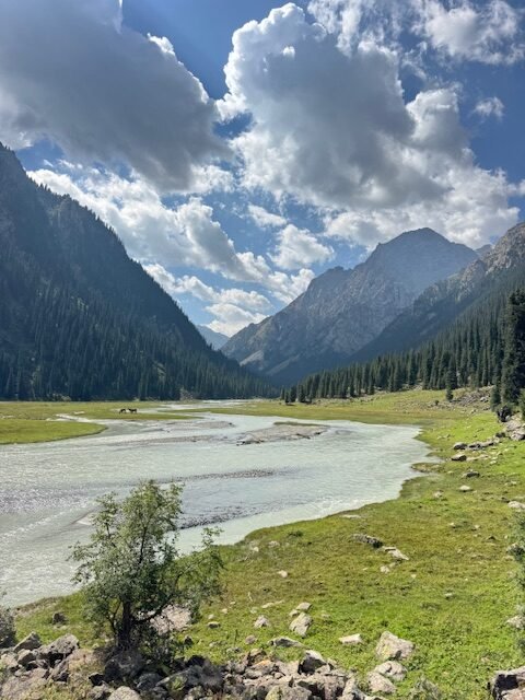
There was actually a nice valley that I wished I had taken the time to enjoy. And it was not far from the first bridge as I was able to reach in after 1:40 of walking. This valley would be a nice day trip from Karakol.
Next came a yurt camp on the left side of the road and then a waterfall. Soon after I arrived at a second yurt camp to cross the suspension bridge (Second Bridge). The suspension bridge has wooden planks held by steel cables above the river.
Second Bridge to Sirota Yurt Camp
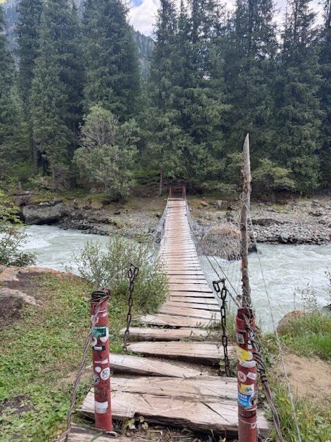
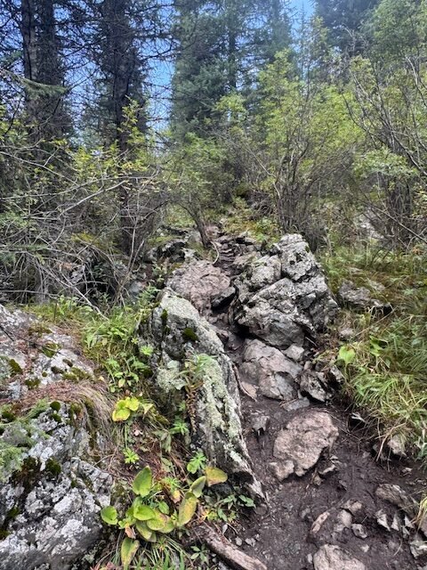
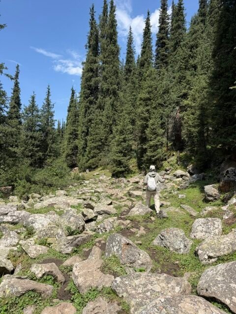
The trail started out nice through the forest. But it was short lived. It soon became muddy as the trail is shared with horses. There were also rocks which could be slippery when wet. Taking your time and watching where you plant your foot means avoiding a rolled ankle. An in some cases, the trail was steep.
The trail opens up about halfway to Sirota camp. Look back occasionally to see the beautiful valley behind. This is also where my legs and lungs started feeling the elevation. Every step was harder and I found myself taking more short breaks.
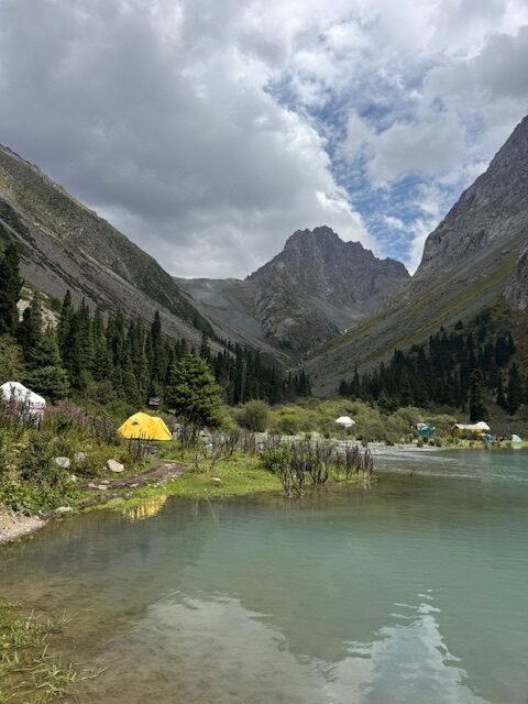
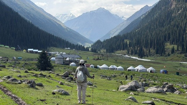
There are at least four yurt camps at Sirota. All of them take walk-ins if there are available beds. You can also buy breakfast and dinner here. There are at least two yurt camps that sell bottled drinks, including water. My yurt camp only had one outhouse that’s a hole in the ground. No shower facilities. There were a few brave souls that dipped in the frigid lake.
There is electricity at the camp as there were lights but not inside the yurts. I did not see any public electrical outlets that can be used for charging.
Sirota Yurt Camp to Alakol
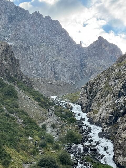
Stay on the left side of the river past Nomad Yurt Camp. If you are self supported, there are a few nice campsites to pitch a tent past Nomad Yurt Camp. In some places, there are even trees to go hammock camping.
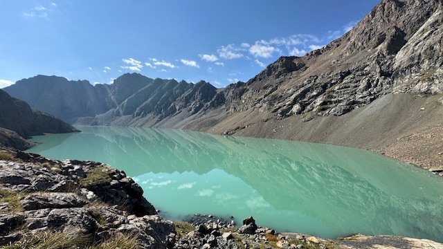
The trail is much better compared to the muddy trail coming up to Sirota. But it is still steep and gets harder as you climb higher. You are about halfway through this section once you reach the waterfall.
Alakol to Alakol Pass
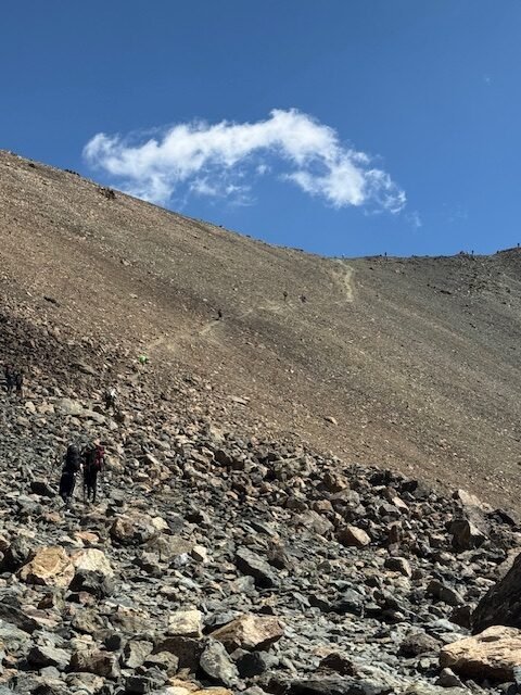
The trail continues on the left side of the lake. It starts off gradual, followed by alternating short steep and gradual sections until the final half killometer (0.3 mi) or so where it becomes brutally steep prior to the pass. But there are plenty of big rocks on the trail side to sit, rest and admire the view.
In some instances, the trail would disappear as you get to a boulder field. Take the time to scan ahead to find where the trail continues.
Alakol Pass to River Crossing
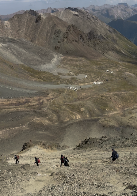
It is now time for the tricky part after enjoying the view of what feels like being on the roof of the world. The big valley and the yurt camps can be seen below as well as the steep trail. I can remember a couple of switchbacks and that was about it. The first hundred or so meters was packed dirt with loose pebbles. Most the people that did not have hiking poles (including me), had to crouch down low and put our hands to the ground or on the mountainside for additional support.
After passing the slippery sections, the rest was kind of easy if you know how to get down on scree surface. What I did is just lean back slightly, plant my heel then let the loose gravel slide down before taking the next step to repeat the process. I want to mention that there were people on all fours going the other way on the way to the pass.
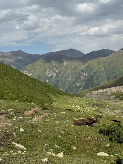
The trail then begins an aggressive descent towards Altyn-Arashan with a flat section across the yurt camp. You will feel it here if you have knee problems. And carrying a heavy pack is going to make it worse.
The valley view is mesmerizingly beautiful. The trail becomes braided but all heading the same direction which is down to the valley. This where having Maps.me becomes handy. There are no trail signs that point you to the river crossing. There are no landmarks either.
The river is shallow but wide. There are large stones scattered across the water. There was a hiker that already made the crossing that guided us on which stones to step on such that we did not have to take off our shoes.
River Crossing to Altyn-Arashan
The trail continues its aggressive descent towards the Arashan River. We encountered sheep and people on horseback. There is a lower and upper trail. Stay on the upper trail as the lower trail which is closer to the river is often used by horses.
The trail then branches at a yurt camp near the Arashan River. Taking the left trail will more likely lead you to take the horse trails on the west side of the river. These horse trails have an upper and lower. The upper seems to be the main horse trail with one stream crossing while the lower has two stream crossings. Both follow the uneven mountain slope so there are short up and down sections.
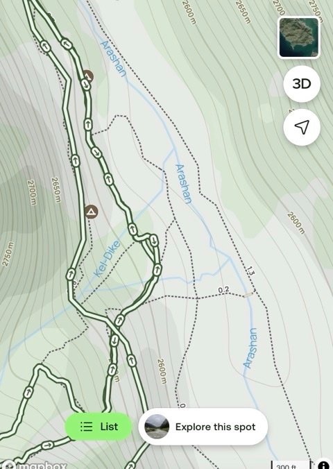
If you head towards the Arashan river past the yurt camp you will will see the log bridge. This is the path shown on AllTrails. This trail is great except for about half a kilometer (0.3 mi) of rocky section about midway between the bridge and the village. For me, I think I would pick the horse trails described above as I would probably end up rolling an ankle in the rocky section while in a hurry to get to the village.
Tips
If I have not made it clear yet, respect the altitude, especially if you are coming from a low elevation. Even with an overnight stay at Sirota Camp at 2960 m ((9,709 ft), I felt a slight headache the following day as I ascended to Alakol Pass.
Hike slow when at elevation. I paused for about half a second in between steps while straightening my back leg. This allowed my bones to take away the weight from my muscles and get a split second rest.
I wished I brought a pair of hiking poles. Though I was not carrying a lot of weight, having those extra legs over slippery rocks would help conserve energy by not having to do a balancing act all the time.
It rained after 4PM at Sirota Camp and about the same time at Altyn-Arashan. Start early, finish early.
It was windy and cold at Alakol Pass. Make sure you dress appropriately.
I don’t know what the hype is about Altyn-Arashan but we did not find it appealing. Sure the valley is nice but getting around was not. The trails have been muddied by horses and 4×4 vehicles. Horse and cow poop are everywhere. Plus it is expensive to get to Altyn-Arashan as you have to hire a private 4×4 to get you in and out. I would not recommend going to Altyn-Arashan just to go there. We feel that going to Kok Kiya Valley to see Kel Suu Lake would be a better option.
How To Get There
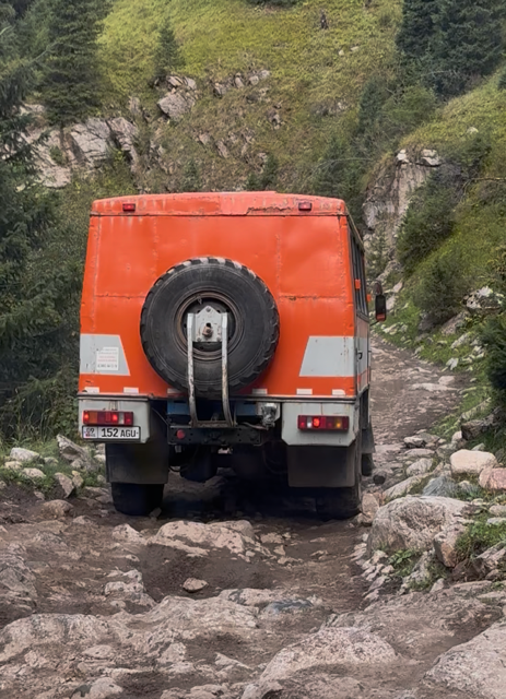
From Karakol: Take the marshrutska 101 or hire a 4×4 to take you either to the first or second bridge.
From Altyn-Arashan Back to Karakol: You can hike down, hire a private 4×4 or take a chance on a shared ride coming out of the village to the town of Ak Suu. From Ak Suu, you can hire another taxi back to Karakol or wait for a marshrutska that goes between Karakol and Jyrgalan.
If you are hiking down or taking the marshrutska to Karakol, the 4×4 from Altyn-Arashan will drop you off about a couple of kilometers from the highway where you can take the marshrutska. More than likely, the marshrutska will be full and may not stop as it has limited trips between Karakol and Jyrgalan.
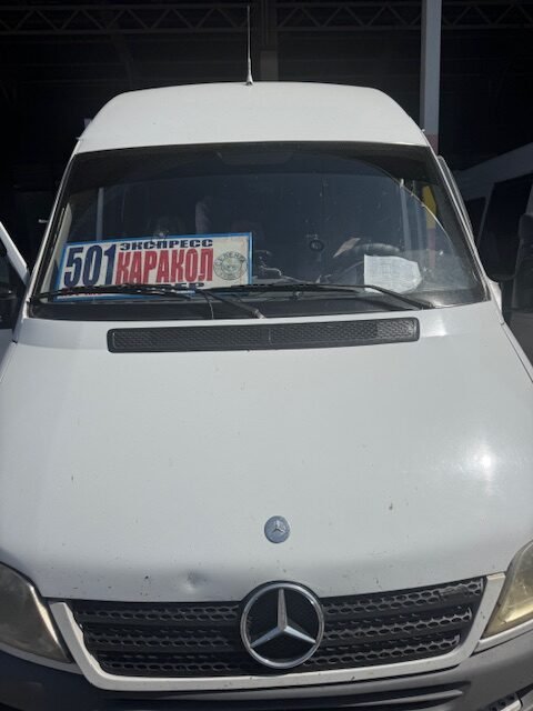
Between Bishkek and Karakol: We saw marshrutkas at the Biskek New Bus Terminal that has Karakol sign on the dashboard.
Where To Stay
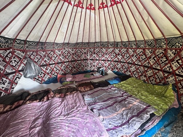
Sirota Camp: You can take your chances at the camp to score a bed in one of the yurt camps. I reserved my spot by booking at Mirano Travel in Karakol. Mirano Travel also rents camping equipment. Mirano travel works with Bulak-Say Yurts at Sirota.
Altyn-Arashan: There are many yurt camps in the valley and a couple basic hotels. My suggestion is go on Maps.me and look for the contact information to book directly. We stayed at Arashan Lodge which we booked on Booking.com. It is hardly a lodge but at least it has an en-suite toilet which is a major upgrade than a yurt. Across Arashan Lodge is what appears to be the newer Guest House Elza which from the outside looked, looked better. Both places offer breakfast and dinner.
Getting Around
Maps.me works great as it shows the trails. Using maps.me with AllTrails will get you through without needing a guide.
Expenses
Costs are in Krygyz som (KGS) and USD. Cash only, except at the park entrance.
Marshrutska 101 – 20 KGS ($0.22)
Shared 4×4 from Karakol to First Bridge – 1,000 KGS ($11)
Park Entrance – 300 KGS ($3.30) (credit card payment accepted)
Bulak-Say Yurt – 2,500 KGS ($27.50) bed only, 1,000 KGS ($11) breakfast or dinner, 3,000 KGS through Mirano Travel
Arashan Hotel – can be booked through Booking.com or walk-in (cheaper)
Altyn-Arashan Entry/Exit Fee – 220 KGS ($2.50)
Private 4×4 Taxi between Karakol and Altyn-Arashan (one way) – 10,000 KGS ($114.40)
Stay Informed
f you want to be notified when we post a new travel story, please enter your email below. We respect your privacy. Your email is used only to notify you of new posts and is never sold or shared with third parties. You can unsubscribe at any time.
Summary
The Alakol and Alakol Pass hike from Karakol to Altyn-Arashan is one of Kyrgyzstan’s classic high-mountain treks. The pass has an elevation of 3,920 m (12,858 ft). The hike is normally done as a loop starting and ending in Karakol with overnight stops at Sirota Camp and Altyn-Arashan. The loop can be done in either direction.
Doing the hike from Karakol and finishing in Altyn-Arashan with an overnight stop at Sirota Camp allows adventurers to break the approximately 1,936 m (6,350 ft) elevation gain. It also allows the body to acclimatize to the high elevation. Sirota Camp has multiple yurt camps. Breakfast and dinner are available besides a bed in a yurt.
For those who prefer to wild camp, there are campsites scattered at designated places along Alakol. But reaching the lake in one day from Kakarol requires completing about 1,500 m of elevation gain in one day.
Reaching Alakol Pass not only gives a sense of accomplishment, but also provides a feeling of being on the roof of the world. Besides having a 360 degree view, several snow covered mountain peaks can be seen.
The descent toward Altyn-Arashan is very steep and loose in places, making trekking poles particularly useful. Although no technical climbing is required, the combination of altitude, substantial elevation gain, steep terrain, and rapidly changing mountain weather makes this a strenuous hike rather than an ordinary backpacking trip.
The combination of a brilliant alpine lake, a challenging high pass, dramatic Tian Shan scenery, and hot springs at Altyn-Arashan makes the Alakol Pass hike one of the most memorable hikes in Kyrgyzstan.