Highlights
A slow travel adventure from Helsinki, Finland to Stockholm, Sweden over sea and land (by bus, cruise ship, ferry, on foot and train).
Time of Visit: September 2024
Duration of Visit: Ten Days
Description
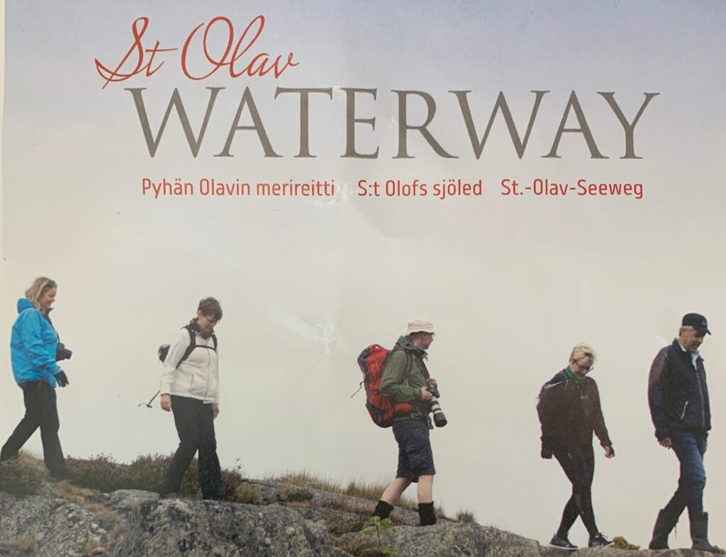
A slow travel from Helsinki, Finland to Stockholm, Sweden is a nice way to see the Finnish countryside and get your exercise at the same time. The bulk of the path follows the St. Olav Waterway pilgrimage route.
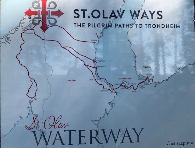
St. Olav Waterway is part of the 1,200 km pilgrimage route from Turku, Finland to Trondheim, Norway. The pilgrimage destination is the Nidaros Cathedral where Olav Haraldsson (995 – 1030) is buried. Olav Haraldsson was king of Norway and became the most important Nordic Saint of the Middle Ages.
St. Olav Waterway is approximately 282 kms long and begins at the Turku Cathedral and ends in Eckero in the Åland peninsula. The journey is normally made on foot when on land and by ferry over sea.
Here we describe our journey from Helsinki to the town of Mariehamn in the Åland peninsula. Mariehamn is normally a pilgrim stop before Eckeros. We ended our journey in Mariehamn to catch the cruise ship to Stockholm, Sweden.
Resources Needed
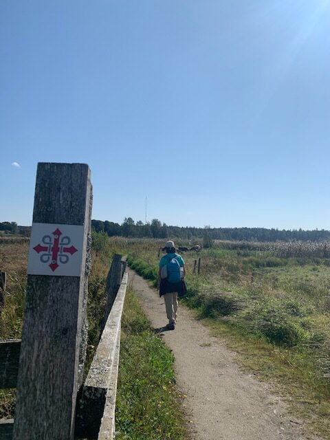
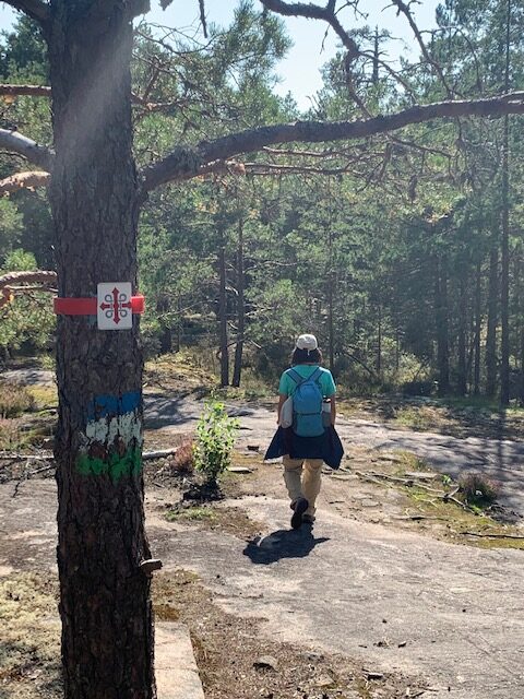
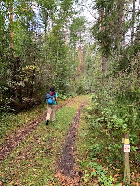
We needed three sets of information to correctly navigate the pilgrimage route. These are Google Maps, turn by turn directions and electronic map of the St. Olav Waterway route. The turn by turn direction came in handy for the first hour of walking from the Turku Cathedral as there were no pilgrimage markers to follow.
After the first hour, we started seeing St. Olav Waterway markers on the trail and roads. But sometimes, the markers were nowhere to be found, especially at road and trail intersections. At intersections, we look ahead a couple of hundred meters to spot any markers. If we did not see any markers, we use Google Maps to find out where we are and compare that to the electronic map to determine the path to take.
We obtained the turn by turn directions at https://stolavwaterway.com/en/maps
Helsinki To Turku
We took the 8:35 AM VR train from the Helsinki Central Station to Turku. The train ride takes approximately two hours. We bought our train tickets a couple of days before our departure so we can just immediately board the train instead of waiting in line to purchase tickets on the day of the trip.
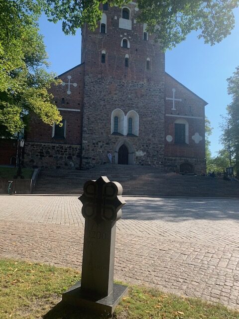
It is approximately a 1.5 kilometer walk from the Turku train station to the cathedral where we were able to obtain a paper map of the St. Olav Waterway route.
St. Olav Waterway
Leg 1 – Turku To Kaarina
This leg is about 16 kilometers and took us about five hours. The first hour was through city sidewalks before it transitioned to forest trails and farmland roads.
We relied heavily on the turn by turn directions for the first hour of walking until we reached the tennis courts. At the tennis courts, the turn by turn directions were unclear as it only said to take the jogging path. We ended up taking the wrong path but luckily it met up with the correct path about a kilometer later. We think that the directions meant the jogging path after the tennis courts.
There were sufficient trail markers to follow when we got back on the pilgrim route. There were only a couple of intersections where we had to check and double check with Google Maps and the electronic map so that we could continue in the right direction.
We parted from the pilgrim route a couple of kilometers before reaching Kaarina so that we could continue on to our AirBnB accommodation.
Leg 2 – Kaarina To Pargas
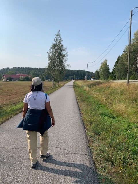
This leg is about 14 kilometers on paved sidewalk right beside the main road. Walking on pavement for about four hours was not fun as our feet took a beating. But at least this leg was straightforward as it followed the main road.
Leg 3 – Pargas To Nagu
The forecast was intermittent rain for the day. The pilgrim route meant walking on the roadside where mostly there was no sidewalk. So we decided to take the 9:45 AM Bus 901 to Nagu. The bus stop at Pargas is at the Neste gas station across the Lidl Supermarket.
We purchased our bus tickets on-line using the Föli app the night before. But when we boarded the bus, the bus driver said that it was not valid. So we used our credit card and purchased the bus ticket from the bus driver.
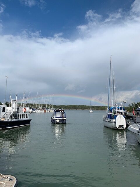
Nagu is a quaint community. It has a marina with a few restaurants and shops. It was just unfortunate that the rain kept us indoors in our AirBnB and did not have a chance to soak in the atmosphere.
Leg 4 – Nagu To Korpo
We walked for about 12 kilometers and rode the bus the rest of the way to get to Korpo.
We left our accommodation around 7:30 AM. The walk followed the old Nagu to Korpo road where we started out walking on secondary roads before transitioning to farm roads and finally a trail. There were occasional St. Olav Waterway markers that guided us.
The trail met up with the main road about a couple of kilometers from the ferry. The rest of the journey to our accommodation in Korpo meant walking alongside the road (no sidewalk). With rain forecasted to begin around noon and continue the rest of the day, it seemed prudent to just take the bus the rest of the way to Korpo. The 10:45 AM bus came as scheduled and we were on it.
Important Omission
The pilgrim route passes through the island of Kokar after Korpo before continuing on to the Åland peninsula. We had to skip Kokar because the ferry did not run on Mondays when we were to continue on with our journey. So we had to spend an extra night in Korpo.
About Korpo
Korpo is served by Bus 901. The community is about four kilometers from the Galtby ferry station. There is one grocery store and the restaurants were closed when we were there. We stayed one night each at Hotel Nestor and an AirBnB midway between the ferry terminal and the community. Plan on bringing your own lunch and dinner if you are staying at Hotel Nestor unless you want to burn a hole in your pocket by eating in its restaurant or go hungry.
Leg 5 – Korpo To Lemland
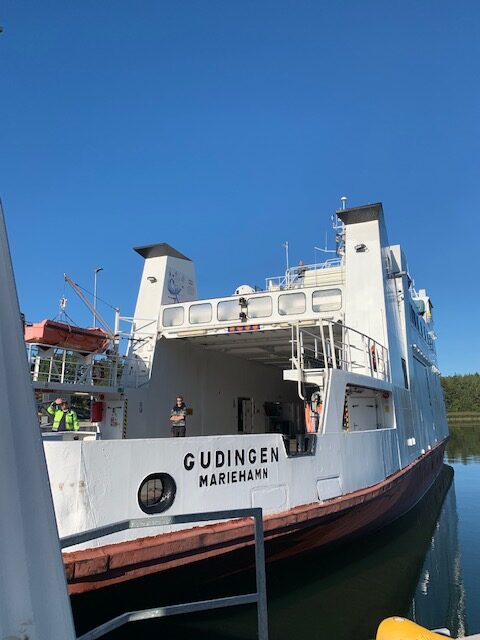
We took the 10 AM ferry from Galtby, Korpo to Langnas in the Åland peninsula. We skipped the 17 km pilgrimage route in Kokar and the 7 km route in Sottunga as we did not have time to stop in those islands. The ferry is free to ride for foot passengers and takes about five hours. No reservation was needed but it is recommended to have one in case there are a lot of people who need to ride that day. The ferry interior seating area is probably large enough for 60 to 70 people with overflow seating for 30 or so more people on the outdoor deck.
We waited at the Langnas cruise ship terminal for the bus to Lemland. We decided to take the bus instead of walking for two reasons. First reason was dinner and the second reason was the path.
There is only one restaurant in Lemland and it closes at 7PM. To avoid missing dinner, this meant we had four hours to cover 21 kilometers on the pilgrimage route to Lemland. We could shorten it to 15 kilometers by walking on the paved footpath on the side of the main road which meant our feet would again get a beating. So we went for the bus to make sure we get dinner and gave our feet a break.
Although the Åland peninsula belongs to Finland, the people here prefer to speak Swedish instead of Finnish. Also, Åland has its own flag and is more similar to the Swedish flag. We had to start saying “tak” (Swedish) for thank you instead of “kiitos” (Finnish).
Leg 6 – Lemland To Mariehamn
This is about a 30 kilometer walk on the pilgrim route. We walked the first 12 kilometers and rode the bus for the last 18 kilometers.
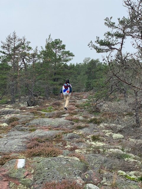
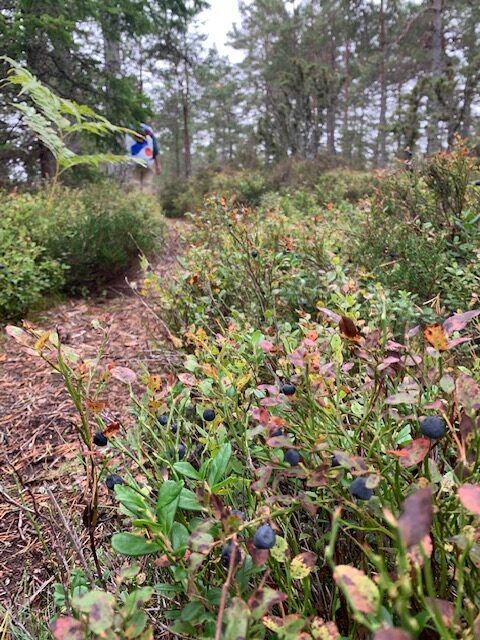
The first 12 kilometers took us through farm roads, forest and sometimes thick brushes that we had to swath away with our arms to get through. Only saw one other person with his dog and a skittish deer. It was a peaceful walk that did not feel long at all.
The last 18 kilometers was on paved footpath and alongside the main road. So we took the bus past the Lemstroms canal and rode it all the way to Mariehamn where we ended our walking adventure.
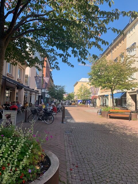
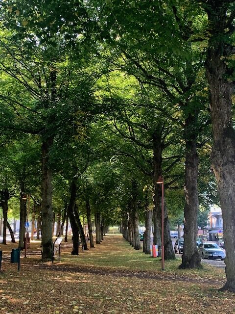
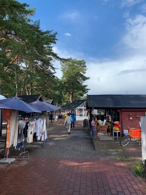
Mariehamn is a nice quiet port town. We did not find much to do in town except to spend a couple of hours walking its promenade where locals hang out at the cafes, restaurants and shops. The town’s tree lined esplanade along Storagatan Street is particularly nice and shady with plenty of benches. But in all fairness, we just did not have the energy to walk around and explore to find out what else was there to do and see.
Mariehamn To Stockholm
There are several cruise ship companies that sail between Helsinki and Stockholm. Most of them make a stop at Mariehamn. We got on the Viking Birka Gotland ship which we thought was a fairly inexpensive way to get to Stockholm (around $100 USD for two with an interior cabin and breakfast buffet). We left port around 7:30 AM and arrived around 2:30 PM (there is a one hour time difference for a total of about eight hours sailing time)
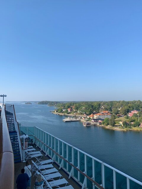
The cruise ship treads through the narrow passageway once it enters the Swedish peninsula. Oftentimes, it was less than a hundred meters from land.
We docked at the Stadsgården, Tegelvikshamn in Stockholm. To get to downtown Stockholm, we walked a couple of hundred meters to the bus stop and took Bus 71T to get to the subway station. We just tapped our credit cards (each person has to have his/her own card) on the bus card reader.
We then purchased our train tickets from the manned ticket booth and took Train 7 to get to the Stockholm Central Station.
Stockholm
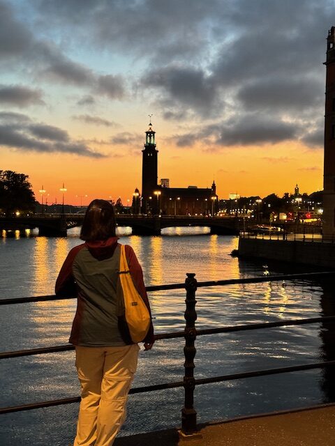
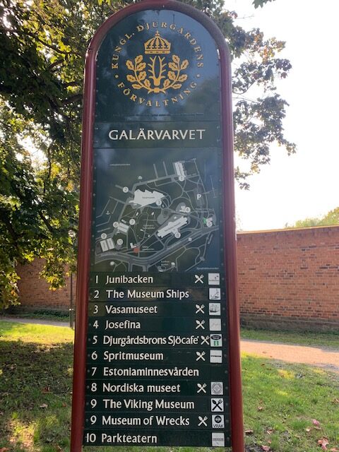
Downtown Stockholm is fairly compact and worth at least a couple of days to explore. Galärvarvet and Djurgården is on an island in downtown Stockholm. Galärvarvet has many pay attractions such as the ABBA and Viking Ship Museums. It even has an amusement park. You could easily spend a day here.
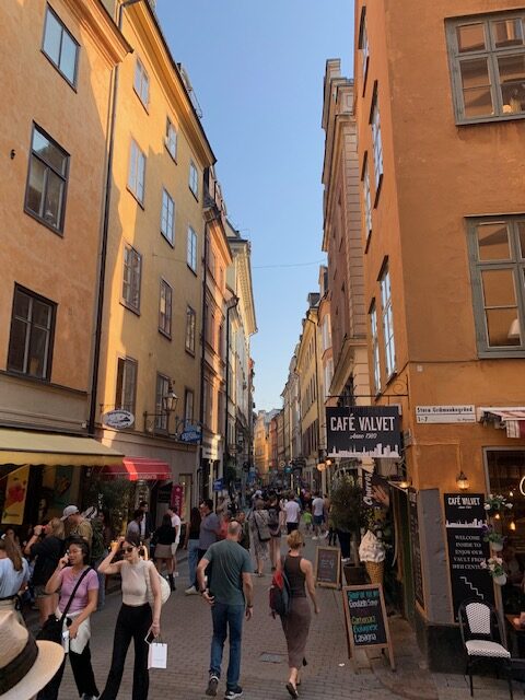
The bustling compact island of Gamla stan is the city’s old town. It has cobbled streets and colorful 17th and 18th century buildings. The Royal Palace and the Nobel Prize Museum are located here. People watching while eating ice cream at the square in front of the Nobel Prize Museum was enjoyable. We particularly enjoyed walking the pedestrian-only streets of Västerlånggatan and Drottninggatan which are lined with cafes, restaurants and souvenir shops.
Summary
A slow travel from Helsinki, Finland to Stockholm, Sweden is a nice way to see the Finnish countryside and get your exercise at the same time. The bulk of the path follows the St. Olav Waterway pilgrimage route.
Part of the route goes through forests, country roads and alongside the main road. We mainly walked when the path was through the forest and country roads as it was more enjoyable than hearing road noise when walking beside the road. We rode buses when the path meant walking on paved surfaces or that there was rain in the forecast.
Logistically, the St. Olav Waterway between Turku and Mariehamn was challenging as accommodation and places to eat were few and far in between. Also ferry schedules were hard to find. But the local bus system helped ease the logistical burden as it provided the means of getting from one place to another. It was also our lifeline during foul weather.
Overall, the journey between Helsinki to Stockholm over land and sea was a nice experience. The serenity of this part of Finland more than made up for what it lacked in scenery.