The Minnesota North Shore spans about 150 miles on Highway 61. It begins from Duluth and runs northeast to Grand Portage just below the Canadian border. Highway 61 runs along the shores of Lake Superior. Along the way, the road climbs up to high vantage points, goes through woodlands and is dotted with state parks, some of which have several waterfalls.
The Wisconsin North Woods begins at the town of Rhinelander and goes northwest on Highways 47 and 51 to Hurley. It then continues on Highway 2 to Ashland and then on Highway 13 to hug the rest of the state’s northern coastline (for the most part). Overall it is about 250 miles of leisurely driving through forest and coastline and little towns.
We only had a weekend to explore this area and had to start from and return to Minneapolis. We realized we could not cover all of it and decided to spend our first day driving to the town of Ashland, WI from Minneapolis. On our second day, we were able to explore the Wisconsin North Woods between Ashland and Superior and were only able to go as far north as Split Rock Lighthouse State Park (SP) on the Minnesota North Shore drive.
The mid-October temperature was above average and the leaves were bright in the Wisconsin Northwoods but already past on the Minnesota North Shore. We were happy for the experience and memories even though we were not able to see all the places that could be explored on these two fantastic itineraries.
Minneapolis to Ashland
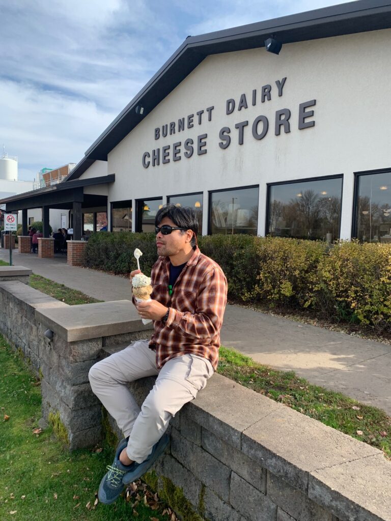
There are several ways to get to Ashland, WI from Minneapolis, MN. All of them are in the three plus hour range. We decided to take WI Hwy 70 from I-35 to Hayward WI. The Burnett Dairy Cooperative was a nice stop along WI Hwy 70 in the small town of Alpha. The cooperative sells several kinds of cheese, some of which you can sample. It also has an ice cream stand (of course), restaurant and some store shelves and beverage coolers. In other words, just stop by and enjoy. We had ice cream and just sat on their half wall watching the cars go by. They also have picnic tables.
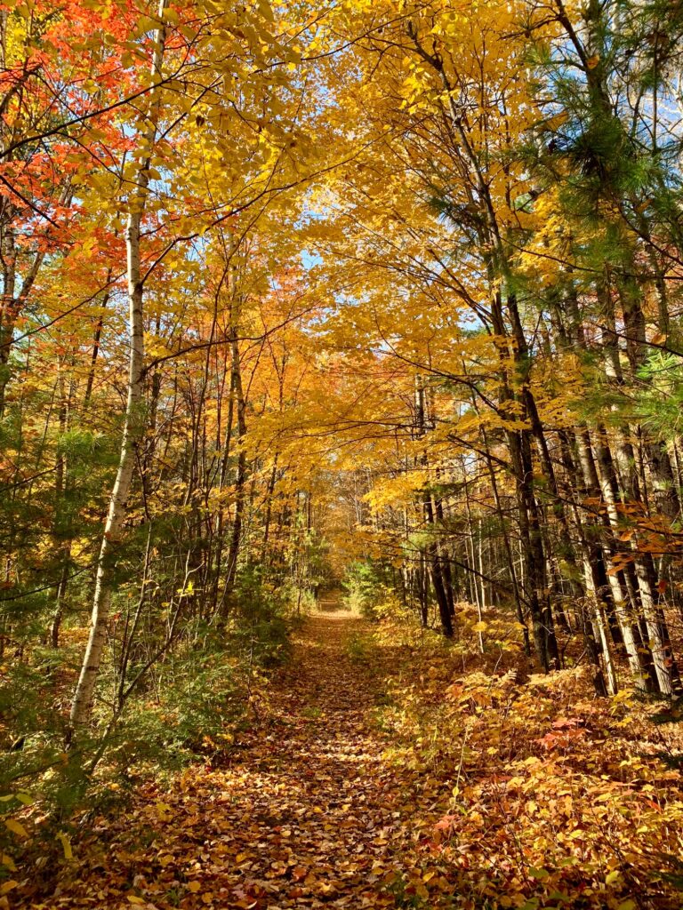
The rest of the leisurely drive going to Ashland was through woodlands and alongside lakes. Our route also followed the designated national scenic river of the St. Croix for a few miles. The river seems ripe to be canoed during summer as we saw several canoe landing signs along the road. We were also surprised to have seen so many lakes on this drive that we thought for a moment if we were still in Minnesota.
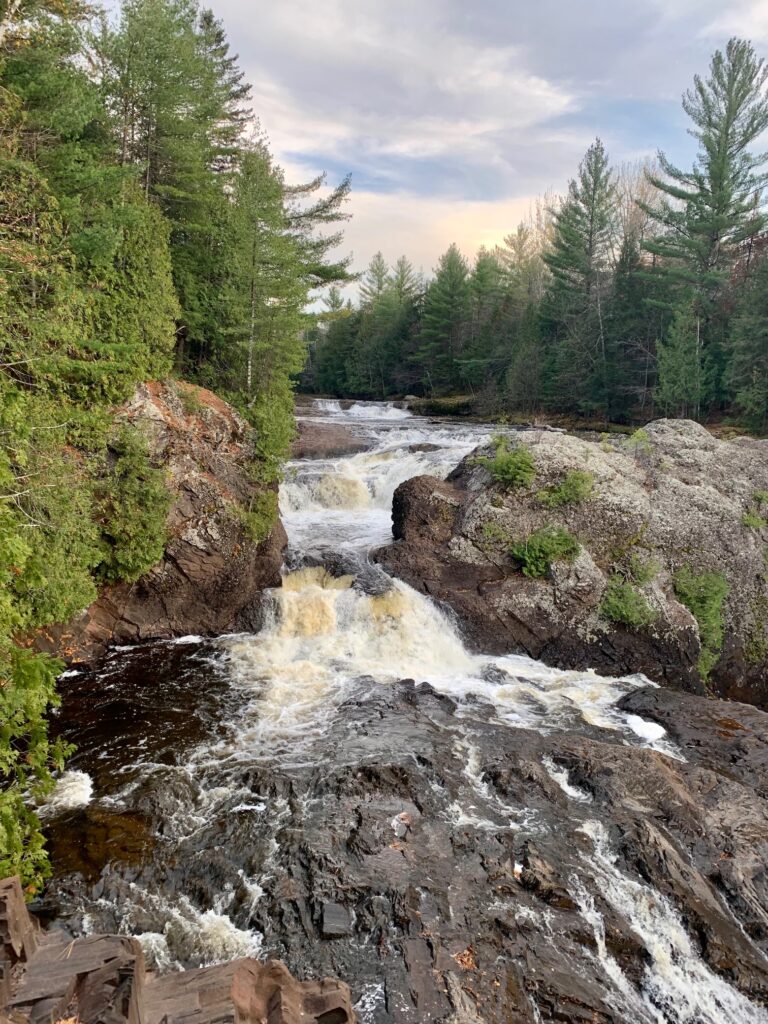
There are also several waterfalls within 50 miles of Ashland, WI. There are Copper and Morgan falls to the south and Saxon and Superior falls to the east. Being short on time, we picked Potato River falls, about 30 minutes from Ashland. There is about a mile and half of dirt road leading to the parking lot from WI Hwy 169. Then it is less than a 15 minute walk to the viewpoint. However, you have to walk down about 120 stair steps which need to be ascended on the way back. No biggie. There is a worn out unmaintained trail to get to the river from the viewpoint.
Ashland to Duluth
Ashland is a small town with a few traffic lights. The town is pretty much dead around 8pm (well maybe besides the liquor store). We stayed at the Best Western Chequamegon which had a nice lobby and a sitting and common area deck facing Lake Superior. It’s the perfect place to enjoy your favorite beverage, unwind and watch the sunset.

From Ashland, we headed north on WI Hwy 13 and stopped at Houghton Falls State Natural Area. The place has a small parking lot, possibly large enough to hold a dozen and half cars. You are out of luck if the parking lot is full as the road adjacent to the parking area has no parking signs on both sides. Also, the parking lot has a sign warning people that they could face a $100 fine or can get towed if they leave their cars parked after 6PM.
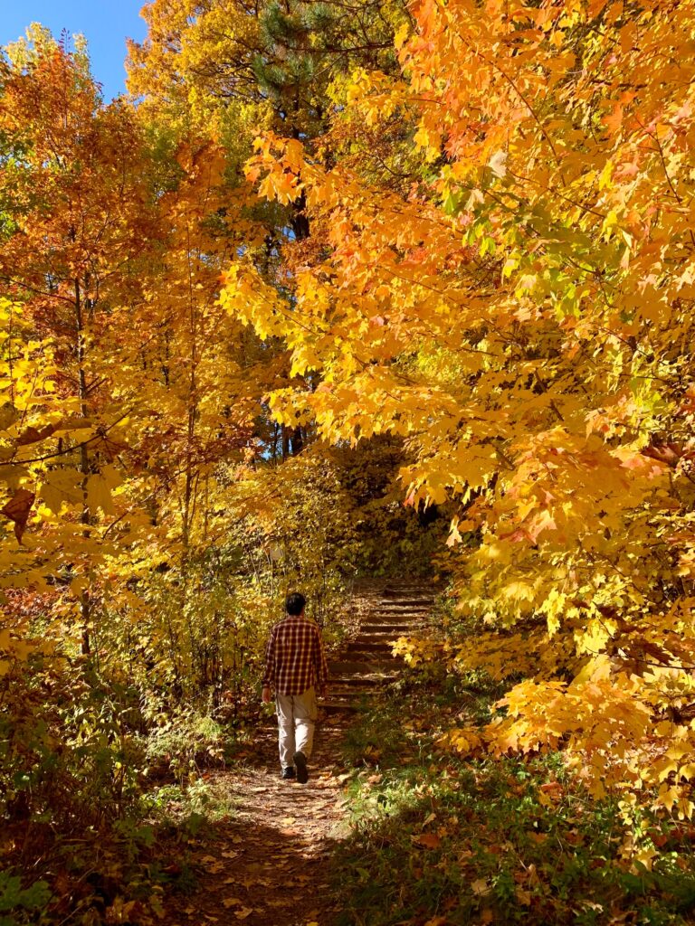
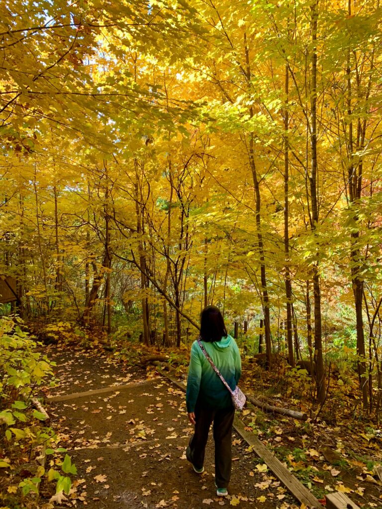
Houghton Falls State Natural Area has a seasonal waterfall and a hiking trail that leads to a rock ledge about 10 feet above Lake Superior. Unfortunately, the creek running through the area was dry so there was no waterfall. However, the wooded trail with its bright autumn colors and seeing the water at the end of the trail was a sufficient reward for us. Best part of the hike is that it was flat and less than a mile one way.

WI Hwy 13 passes through the lakeside town of Bayfield. The town was pretty quiet on a Sunday morning. Hardly a car on the business streets nor people walking about. We decided to stop by Bayfield because there was a sign on the highway that said “Apostle Islands Visitor Center”. The visitor center is the park headquarters for Apostle Island as it is part of the federal park system. The headquarters was closed for the season but we found a Bayfield Chamber and Visitor Bureau right at the corner of Moneypenny Ave and S Broad Street. There was nobody inside the bureau but the door was open so we helped ourselves to a few printed information including the Apostle Islands park map.
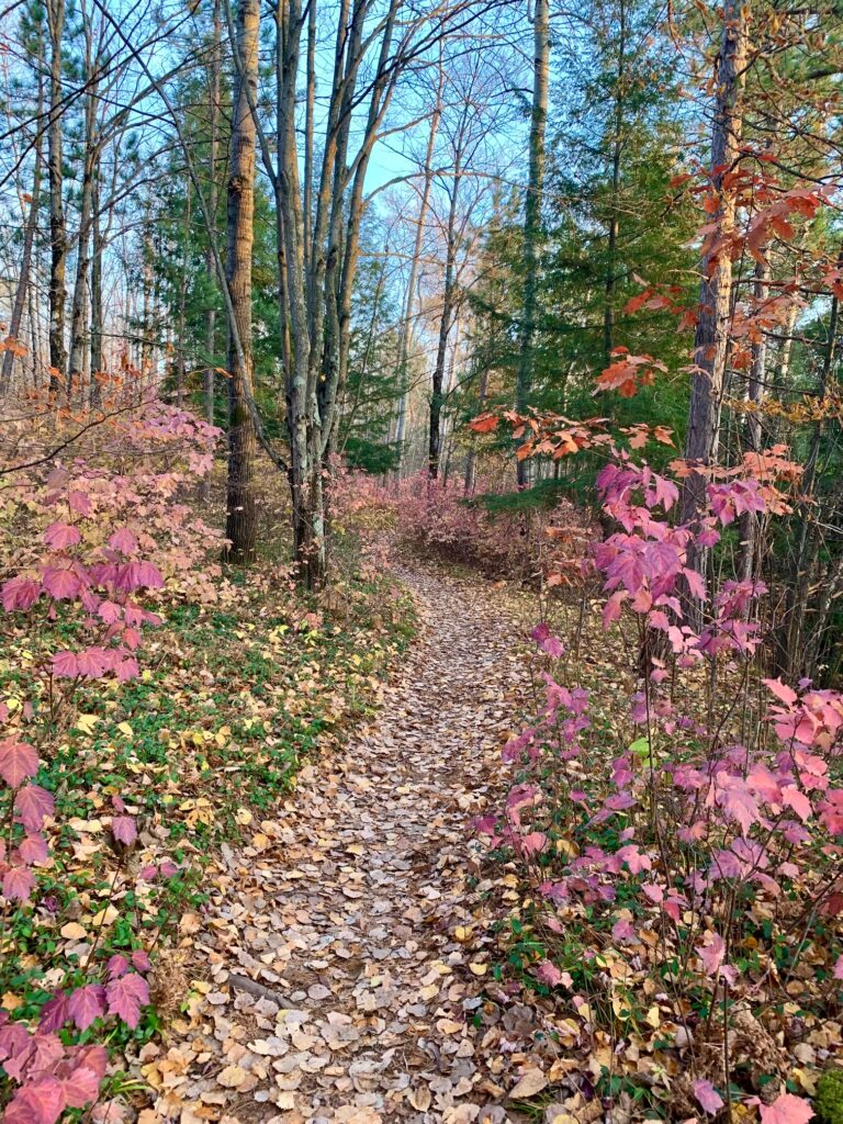
Armed with the map, we proceeded to drive out of Bayfield but noticed a local park that had a sign that said “Iron Bridge and Nature Trail”. Whoa, we need to explore this and we did, at least partially. As the sign said, there is an iron truss foot traffic bridge about 25-30 feet above a little creek. The bridge has benches and lampposts that seemed perfect for an early morning or late afternoon stroll. As we followed the trail alongside the creek, we came upon a posted map about the trail system. The park actually has miles of trails and we could not possibly cover it in one day. So we just hiked for about 20 minutes and soaked in the tranquility of the place.
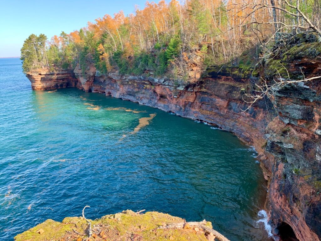
After Bayfield, we proceeded to Meyers Beach off Hwy 13 to tackle the Lakeshore Trail. We were hoping to see a glimpse of the sea caves but alas, those were not visible from the trail (only from the water). Our plan was to go as far as The Bowl which is a 2.2 mile easy hike (one way) from Meyers Beach. The trail is fairly flat with about eight sections of descent/ascent between 10 and 30 feet of elevation difference. The first ¾ mile is on wooden boards which makes it nice as there is little chance of tripping (except when there are stairs) and provides an even surface. The next half mile of the trail has wooden boards set at some boggy locations while the rest is on dirt and exposed tree roots.
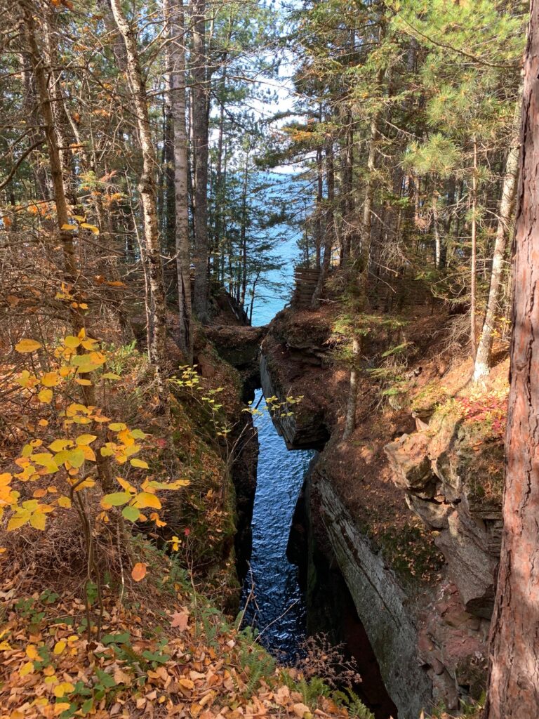
It took us about an hour to get to The Bowl including rest stops and taking photos, especially at the sea cave overlook. Overall, it was a nice sunny day for a fall hike although most of the leaves were already on the ground. There were some people on the trail but not even close to being congested. The parking lot was less than a quarter full that early afternoon.
One thing to mention is that Myers Beach is a fee area. There is a pay station but was out of order at the time. However, a QR code can be scanned at the fee station that allowed us to purchase the $5 (at the time) fee. Your national park pass should be accepted here as its part of the national park system.
Minnesota North Shore on Hwy 61
We started our north shore drive from Duluth around 4PM so there was around two hours of daylight left. Our plan was to drive as far as Split Rock Lighthouse SP, then to Gooseberry Falls SP and have dinner at Betty’s Pies just north of the downtown Two Harbors.
The Minnesota state park system requires all vehicles to have a permit when inside the park regardless of the time of the year. One can either buy a daily ($7 in 2022) or annual ($35) passes. We opted for the daily pass because we had to enter our rental vehicle license plate while purchasing it on-line earlier that day. The park entrance booths (where you can purchase an entry permit) at Split Rock and Gooseberry were closed by the time we arrived. It was probably closed for the season as well as it was after normal working hours. So it would be advisable to purchase the permit on-line and be legit instead of risking a ticket.
As we left the city of Duluth, going north on Hwy 61, the road would split. The one to the right is the scenic drive that hugs the coastline while the one to the left is the continuation of Hwy 61. Short on time, we opted for the interstate like Hwy 61. The scenic drive eventually meets Hwy 61 just before the main town of Two Harbors, so it’s quite a distance. If we had time to spare, we would have definitely taken the scenic drive as there was nothing special along Hwy 61.
At Split Rock Lighthouse SP, the entrance road splits after the entrance office. To the right leads to the park itself while the left takes visitors to the lighthouse. The park has bicycle and foot trails and campgrounds. There are trails that lead to the rocky and cobbled shore. There is a short trail from the Trail Center where iconic lighthouse photos can be taken as well as sunrise or sunset photos.
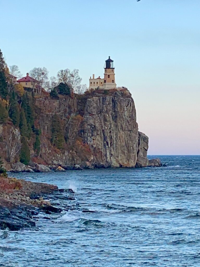
After you have visited the park, you can just turn around and leave unless you just want to buy some souvenirs and/or pay the additional fee ($12 pp at the time) to go to the lighthouse. We opted not to as we were short on time.
We arrived at Gooseberry Falls SP with the light fading fast so we followed the signs that pointed to the falls. At the parking lot, there are two paved footpaths that both lead to the visitor center. The visitor center was closed by the time we arrived. The footpath splits again behind the visitor center. The right path leads to the middle and lower falls while the left leads to the upper falls. There are less than 100 flights of stairs leading down to the middle falls viewpoint. From there, it’s a short slightly downhill paved path to view the lower falls. There are a few more stairs that need to be tackled if one wishes to be at the base of the lower falls.
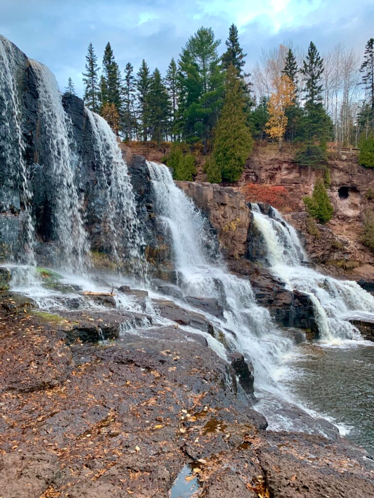
Walking back to the middle falls viewpoint, there is a stair that leads up to the upper falls footpath. The upper falls footpath goes under Hwy 61 where the falls become visible.
The final stop was Betty’s Pies, just north of the Two Harbor’s town center. I had Betty’s Special while my wife opted for fish and chips. Betty’s Special offers half a chicken sandwich, a cup of soup of the day (which was wild rice) and a slice of pie. It seemed like a good deal considering that the pie alone costs half of the entire entree. My wife’s fish and chips was so-so and had more fries than fish. Their pies are definitely good.
Summary
We realize we covered a lot in this two day road trip and barely scratched the surface. But the important thing is to get away, enjoy what was important to us and not worry about what we could not see. After all, those attractions are not going anywhere and we could always come back.
On the Wisconsin North Woods drive, we skipped some towns and natural attractions beginning from Reinlander, WI. Several more waterfalls are a short drive from Ashland, WI. Exploring the Apostle Islands could demand several days. There is a ferry service at Bayfield, WI that was closed for the season. The ferry goes to Madeline Island, the largest of the Apostle Islands. There are also boat tours to the different islands leaving from Bayfield. Also the wild and scenic section of the St. Croix River beacons to be explored.
On the Minnesota North Shore, there are more attractions North of Split Rock Lighthouse SP. There are several waterfalls between Cascade Falls, Temperance River and Tettegouche state parks. There are also hiking trails to explore. We actually wanted to do the highly rated Oberg Mountain trail near the town of Lutsen that we saw featured in a Minneapolis’ local television show. And there is the town of Grand Marais, the start of the Gunflint Trail and gateway to the eastern side of Voyageurs National Park. You can easily spend a week in this one of a kind national park canoeing several lakes and camping on islands as I did back in the 1990’s.
We hope that this blog inspires you to plan your own adventures in the Minnesota North Shore and the Wisconsin North Woods.